Connecticut
Ages 5–11 · 9 minutes · Geography
What do PEZ, clam pizza and dino tracks all have in common?
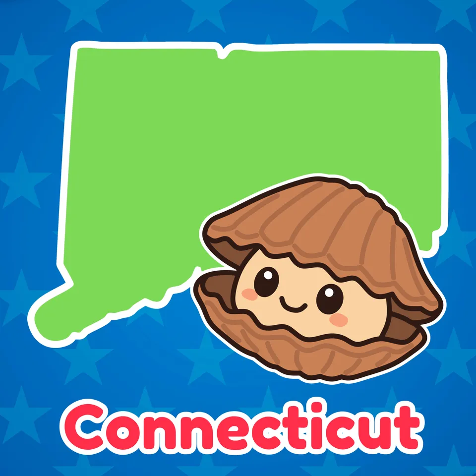
From historic seaports to real dinosaur tracks, Connecticut is full of big surprises in a small place! Connecticut is famous for tasty clam pizza and even for the colorful candy called PEZ! With its rich history, ocean views and fun finds around every corner, Connecticut has plenty to keep curious explorers smiling!
Part of
Standards alignment
Common Core State Standards
- D2.Geo.6.K-2 — Individually and with others, students… Identify some cultural and environmental characteristics of specific places.
- D2.Geo.1.K-2 — Individually and with others, students… Construct maps, graphs, and other representations of familiar places.
Alabama
- SS10.2.6 — Identify states, continents, oceans, and the equator using maps, globes, and technology.
- SS10.5.1.1 — Locating on a map states and capitals east of the Mississippi River
- SS10.2.10.3 — Recognizing benefits of recreation and tourism at state and national parks (Alabama)
Alaska
- 1 — know that places have distinctive geographic characteristics;
- 2 — understand the people and the political, geographic, economic, cultural, social, and environmental events that have shaped the history of the state, the United States, and the world;
Arizona
- 2.G1.1 — Use and construct maps, graphs, and other geographic representations of familiar and unfamiliar places in the world; and locate physical and human features. • Key physical features include but are not limited to seven continents, oceans, lakes, rivers, mountain ranges, coasts, seas, and deserts • Key human features include but are not limited to equator, hemispheres, North and South Pole, cities, states, countries, regions, and landmarks
- 2.G1.2 — Use maps, globes, and other simple geographic models to identify and explain cultural and environmental characteristics of places in the world based on stories shared. Arizona History and Social Science Standards modified 8/23/19 Page 19
- 1.H4.1 — Explain and explore origins of key American symbols, documents, landmarks, holidays, and leaders as well as their importance from the past to the present in our country. • Symbols include but are not limited to American flag, bald eagle, Statue of Liberty, White House, Washington Monument, Mount Rushmore, Liberty Bell, United States Capitol, and Arizona state symbols • Holidays include but are not limited to Columbus Day, Thanksgiving, Veterans Day, Memorial Day, Labor Day, Presidents Day, Martin Luther King Jr. Day, Independence Day, Constitution Day, and Arizona Statehood Day • Leaders include but are not limited to local and/or Tribal leaders, state leaders, and national leaders
- 5.G1.1 — Use and construct maps and graphs to represent changes in the United States. • Key concepts include but are not limited to physical and human features of the United States, the regions of the United States and their characteristics, geographic location of major events, the growth of the United States through territorial expansion, demographic changes, and the states and their capitals
Arkansas
- G.1.1.2 — Describe the physical and human characteristics of a place including roads, buildings, and borders using maps, globes, and photographs.
- G.1.2.10 — Examine how the products that are consumed and the traditions that are celebrated connect people to different parts of the world (e.g., raw materials, art, food, culture).
- G.1.K.2 — Identify and describe the physical characteristics of a place such as rivers, mountains, and forests using maps, globes, and photographs.
- G.1.1.9 — Discuss how the products that are consumed connect the local community to other parts of the country and rest of the world such as clothes, toys, and food.
California
- 3.4.5 — Describe the ways in which California, the other states, and sovereign American Indian tribes contribute to the making of our nation and participate in the federal system of government.
Colorado
- SS.1.4.2 — Identify and explain how the significance of notable people, places, holidays, and civic symbols reflect the origins and values of the government and its citizens.
- SS.2.2.1 — Use geographic terms and tools to locate and describe spatial patterns and places.
- SS.3.2.1 — Use geographic tools to develop spatial thinking skills.
Connecticut
- GEO 2.3 — Use geographic representations to identify cultural and environmental characteristics of place.
- GEO 1.3 — Use maps, globes, and other simple geographic models to identify cultural and environmental characteristics of places.
- GEO 3.3 — Use maps of different scales to describe the locations of cultural and environmental characteristics.
Delaware
- G.1.4-5a — Students will demonstrate development of mental maps of Delaware and of the United States which include the relative location and characteristics of major physical features, political divisions, and human settlements. Grade 4
- K-3a — Students will use the concepts of place and region to explain simple patterns of connections between and among places across the country and the world. Grade 3
- G.3.K-3a — Students will identify types of human settlement, connections between settlements, and the types of activities found in each. Grade 3
Florida
- SS.3.G.2.5 — Identify natural and man-made landmarks in the United States, Canada, Mexico, and the Caribbean.
- SS.5.G.1.6 — Locate and identify states, capitals, and United States Territories on a map.
- SS.1.A.2.5 — Distinguish between historical fact and fiction using various materials.
- SS.3.G.2.4 — Describe the physical features of the United States, Canada, Mexico, and the Caribbean.
Georgia
- SS1G3.c — Identify and describe landforms (mountains, deserts, valleys, and coasts).
Hawaii
- SS.1.2.14.3 — Investigate cultural and environmental characteristics of your community
- SS.1.3.17.1 — Investigate historically significant events, people, and observances in history
- SS.2.3.13.4 — Describe major geographic features of places using maps, photos, and other geographic representations
Idaho
- 5.SS.2.1.4 — Name and locate the 50 States and their Capitals, and U.S. Territories.
Illinois
- SS.2.G.1 — With guidance and support, use print and digital maps, globes and other simple geographic models to identify cultural and environmental characteristics of places.
- SS.2.G.2 — With guidance and support, identify some cultural and environmental characteristics of your community and compare to other places or regions.
- SS.3.G.1 — Use print and digital maps, globes, and other simple geographic models to identify topographic and other graphic representations of both familiar and unfamiliar locations.
Indiana
- 5.G.2 — Use maps and globes to locate states, capitals, major cities, major rivers, the Great Lakes, and mountain ranges in the United States. (E)
Iowa
- SS.K.14. — Compare environmental characteristics in Iowa with other places.
Kansas
- Benchmark 3.3.1 — The student will recognize and evaluate how societies are shaped by the identities, beliefs, and practices of individuals and groups.
- Standard 3.3 — Societies are shaped by the identities, beliefs, and practices of individuals and groups.
Kentucky
- 2.G.GR.1 — Examine geographic features of places in North America, using a variety of geographic data, including maps, photos and other geographic tools.
- K.G.KGE.1 — Identify physical and environmental characteristics of communities.
Louisiana
- 2.21 — Describe geographic features and physical characteristics of places in the United States and the world, including mountains, hills, plains, deserts, coasts, islands, peninsulas, lakes, oceans, and rivers.
- 3.20 — Describe the geographic features of places in the United States.
- 3.28 — Describe how the regions of the United States vary culturally and economically.
Massachusetts
- 3.T2.2 — On a political map of the current United States, locate the New England states (Connecticut, Rhode Island, Massachusetts, New Hampshire, Vermont, and Maine).
Michigan
- 4–G1.0.3 — Use geographic tools and technologies, stories, songs, and pictures to answer geographic questions about the United States.
- 4–G2.0.2 — Locate and describe human and physical characteristics of major U.S. regions and compare them to the Great Lakes region.
Minnesota
- 4.3.2.3.1 — Locate and identify the physical and human characteristics of places in the United States, and also Canada or Mexico. For example: Physical characteristics—landforms (Rocky Mountains), ecosystems (forest), bodies of water (Mississippi River, Hudson Bay), soil, vegetation, weather and climate. Human characteristics— structures (Statue of Liberty), bridges (Golden Gate Bridge), canals (Erie Canal), cities, political boundaries, population distribution, settlement patterns, language, ethnicity, nationality, religious beliefs.
- 4.3.2.4.1 — Name and locate states and territories, major cities and state capitals in the United States.
- 3. — Places have physical characteristics (such as climate, topography vegetation) and human characteristics (such as culture, population, political and economic systems).
Mississippi
- 5.10.2 — Identify and label each of the 50 states on a map.
- K.H.1.2 — Identify school, community, state, and national symbols.
- 6.5.1 — Describe the distinguishing physical and human characteristics of the United States and other countries.
Missouri
- 4.EG.5.B.a — Name and locate specific regions, states, capitals, river systems and mountain ranges in the United States based on historical or current topics.
- 4.EG.5.C.b — Identify and compare diverse human geographic characteristics of the nation.
- 5.EG.5.B.a — Name and locate specific regions, states, capitals, river systems and mountain ranges in the United States based on historical or current topics.
Montana
- SS.G.5.1 — identify and label US regions, territories, states and their capitals/major cities;
- SS.G.K — The geography content standard for kindergarten is that each student will use maps, and other representations, to describe place characteristics.
- SS.G.1.1 — identify and describe human and physical local landmarks; and
- SS.G.3.3 — identify landforms and other physical characteristics of the Americas.
Nebraska
- SS 1.3.2 — Explore places and regions.
- SS 1.3.5 — Use geographic skills to make connections to students’ lives.
- SS 5.3.1 — Explore where (spatial) and why people, places, and environments are organized in the United States.
- SS 5.3.1.a — Use maps and atlases to locate major human and physical features in the United States.
Nevada
- SS.2.21 — Identify major national landmarks associated with historical events.
New Hampshire
- SS.GE.2.1.3 — Identify major physical and human features in the United States and on Earth, e.g., cities, oceans, or continents. (Themes: C: People, Places and Environment, G: Science, Technology, and Society)
- SS.GE.2.2.1 — Explore the physical and human characteristics of place, e.g., roads, schools or mountains. (Themes: C: People, Places and Environment, E: Cultural Development, Interaction, and Change, G: Science, Technology, and Society)
- SS.HI.2.1.1 — Identify national and New Hampshire celebrations, monuments, symbols and documents, e.g., flags, Fourth of July, Lincoln Memorial, Constitution. (Themes: A: Conflict and Cooperation, B: Civic Ideals, Practices, and Engagement, E: Cultural Development, Interaction, and Change)
New Jersey
- 6.1.2.Geo.HE.3 — Identify cultural and environmental characteristics of different regions in New Jersey and the United States.
New Mexico
- 5.27 — Using a map, identify and locate the 50 states in the United States and know the capitals of each state along with the surrounding U.S. territories.
- K.10 — Identify the local, state, and national symbols (e.g., flag, bird, song).
- 1.18 — Use a variety of maps to locate specific places and identify major landforms, bodies of water, and other places of significance around the United States.
New York
- E.1.2 — Important ideas, social and cultural values, beliefs, and traditions from New York State and United States history illustrate the connections and interactions of people and events across time and from a variety of perspectives.
- I.1.1 — The study of New York State and United States history requires an analysis of the development of American culture, its diversity and multicultural context, and the ways people are unified by many values, practices, and traditions.
North Carolina
- 2.H.1 — Understand how various people and events have shaped America.
- 2.G.1.1 — Recognize absolute and relative location of various settlements, territories, and states in the development of the American nation.
- 5.G.1.1 — Explain the relationship between location, physical environment, and human activity in the United States.
North Dakota
- 5.C.6 — Engage in a range of discussions using active listening skills, posing and responding to specific questions to clarify information.
- 5.R.1 — Comprehend information during and after listening to a grade-level text.
Ohio
- 1.5 — Places are distinctive because of their physical characteristics (land forms and bodies of water) and human characteristics (structures built by people).
- SL.K.4 — Describe familiar people, places, things, and events and, with prompting and support, provide additional detail.
Oklahoma
- 4.2.5 — Identify and locate on a political map the fifty states and the United States capitol.
- 4.3.2 — Examine the characteristics of culture, including the distribution and complexity of the regions of the United States. A. Identify the characteristics of culture (language, customs, beliefs, food, clothing, shelter) and compare the cultural characteristics of different regions of the United States. B. Explain how the characteristics of culture affect the ways in which people live.
- 4.2.2 — Identify major physical features in the United States and analyze how physical processes shape places. A. Identify and describe the physical characteristics of places, including the major landforms, bodies of water, vegetation and climates in the United States. B. Describe the location and characteristics of the major ecosystems in the United States.
Oregon
- 6.14 — Identify and describe how the physical and human characteristics of places and regions connect to human identities and cultures in the Western Hemisphere.
Pennsylvania
- 7.1.3.B — Identify and locate places and regions.
- 7.3.3.B — Identify the human characteristics of places and regions by their cultural characteristics.
- 7.2.3.A — Identify the physical characteristics of places and regions.
- 8.3.3.B. — Identify and describe primary documents, material artifacts and historic sites important in United States history.
Rhode Island
- SS3.2.2 — States in the Northeast Explain the states that make up the Northeastern region including their admittance to the United States and their identities
- SS3.2.4 — The Northeastern region today Argue how the geography and environment of the Northeastern region contributed to its social, cultural, and economic development
- SS3.2.1 — Geography and environment of the Northeast Explain the geography and environment of the Northeastern region of the United States
South Carolina
- 2.G.2 — Describe and compare various landforms over time within the U.S. through the use of primary and secondary sources. This indicator was developed to encourage inquiry into using historic images, maps, narratives, texts, or video, to investigate and compare different landforms around the U.S.
- 3.1.3.PR — Identify the spatial hierarchy of political and physical geographic features. This indicator prompts students to inquire about spatial hierarchies (i.e. scale) to understand connections between Earth's systems. Political features include cities, states, and countries. Physical features include forests, mountains, oceans, and rivers.
- K.G.2 — Utilize sources of geographic information (e.g., digital sources, maps, or photographs/images) to define and identify cultural and/or natural features.This indicator was developed to encourage inquiry into natural features, such as mountains, oceans, and rivers and cultural features, such as buildings, restaurants, roads, and stores.
South Dakota
- K.G.1.1 — Recognize that maps and globes represent places
- K.SL.4 — Describe familiar people, places, things, and events. With prompting and support, provide additional detail.
- 4.G.1.1 — Locate major political and physical features of South Dakota and the United States on a map or globe
Tennessee
- 3.09 — Identify and locate the fifty states of the U.S.
- SSP.06 — Develop geographic awareness by: • Identifying geographic symbols on maps and globes • Understanding relationships between people, places, and resources
Texas
- 1.5A — identify and describe the physical characteristics of place such as landforms, bodies of water, Earth's resources, and weather; and
- 1.5B — identify and describe how geographic location influences the human characteristics of place such as shelter, clothing, food, and activities.
- 2.11D — identify symbols such as state and national birds and flowers and Uncle Sam; and
- 2.1B — identify and explain the significance of various community, state, and national landmarks such as monuments and government buildings.
- 5.6C — locate on a map important political features such as the five largest cities by population in the United States and the 50 states; and
Utah
- K.2.3.b — Recognize state and national symbols (e.g., state and national flags, bald eagle, seagull, Statue of Liberty).
Vermont
- D2.Geo.6.K-2 — Individually and with others, students… Identify some cultural and environmental characteristics of specific places.
- D2.Geo.9.K-2 — Individually and with others, students… Describe the connections between the physical environment of a place and the economic activities found there.
Virginia
- USI.1.c — The student will apply history and social science skills to understand the geography of North America by locating the 50 states.
- Skill.3.b — The student will apply history and social science skills to the content by applying geographic skills to identify and understand geographic features and connections.
Washington
- G1.3.2 — Investigate the physical, political, and cultural characteristics of places, regions, and people in North America, including the location of the fifty states within the regions of the United States.
- G2.2.1 — Identify some common and unique cultural and environmental characteristics of specific places.
- G1.2.2 — Use maps, globes, and other simple geographic models to identify cultural and environmental characteristics of places.
Washington, D.C.
- 1.23 — Describe how location, weather and physical environment affect the way people live, including the effects on their food, clothing, shelter, transportation and recreation.
- 3.5 — Compare the physical, economic and demographic features of the District of Columbia to America’s 50 states and territories, including size and population.
West Virginia
- Use maps, graphs, photographs, and other representations to describe places.
- SS.5.17 — Compare and contrast the various regions of the United States; locate each of the fifty United States and correlate them with their regions.
Wisconsin
- SS.Geog4.a.4 — Describe how certain places may have meanings that distinguish them from other places (e.g., cemetery, places of worship, state or national parks, historical park, or battlefield). Compare and contrast the human characteristics of rural, suburban, urban, and tribal locations in Wisconsin and the United States. Identify and describe how people may view places in the community differently (e.g., students and senior citizens responding to a new playground).
- SS.PS1.a.K-1 — Describe symbols, songs, and traditions that identify our state and country. Assess the importance of rules and laws at home, in school, and in the community.
Wyoming
- SS2.5.3 — Human Place and Movement Use the human features of a community to describe what makes that community unique (e.g., cultural, language, religion, food, clothing, political, economic, population, and types of jobs in an area) and why others move to or from that place. RL.1.2, RL.2.3 RI.1.3, Rl.2.2, RI.2.10 W.K.2, W.K.7 W.1.1, W.1.7 W.2.1 W.2.7 SL.K.4, SL.1.4, SL.2.2 K-2-ETS1-1
- SS2.5.1 — Spatial Use a map, globe, and mental mapping to identify familiar areas and simple patterns and create maps using various media. 2-ESS2-2
- SS5.5.3 — Human Place and Movement Describe the human features of an area (e.g., language, religion, political and economic systems, population distribution, and quality of life), past and present settlement patterns (e.g., Indigenous Tribes of Wyoming and the Oregon Trail), and how ideas, goods, and/or people move from one area to another. Benchmark_Component Sub-Item :SS5.5.3.a.i Human Place and Movement Describe how cultural values of the Indigenous Tribes of Wyoming influence the importance and preservation of place and sacred sites (e.g., Devils Tower/Bear Lodge, Hot Springs State Park, Vedauwoo, Crowheart Butte, Bighorn Medicine Wheel, Estes Park, Yellowstone, Heart Mountain, and Wind River Mountains). Benchmark_Component Sub-Item :SS5.5.3.a.ii Human Place and Movement Describe and identify a variety of place names and their connection to Indigenous Tribes of Wyoming. RL.3.2, RL.4.7, RL.4.9 RI.3.3, RI.4.3, RI.5.3 W.3.2, 3.7, 4.2.b, W.5.2.b, 5.7 SL.3.4