Iowa
Ages 5–11 · 11 minutes · Geography
Ice cream, corn fields and butter sculptures...Iowa might make you hungry!
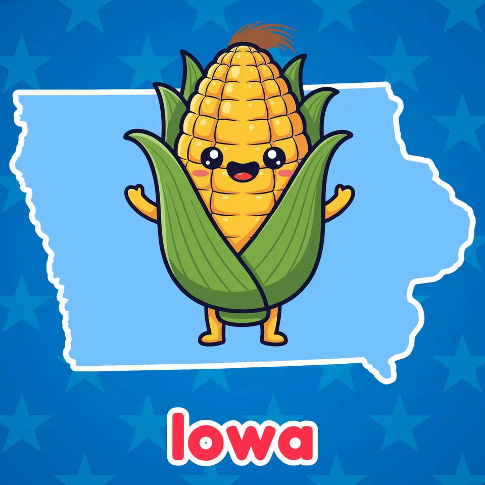
With ice cream, corn fields and butter sculptures, this lesson just might make you hungry! Let's learn all about Iowa!
Part of
Standards alignment
Common Core State Standards
- D2.Geo.2.3-5 — Individually and with others, students… Use maps, satellite images, photographs, and other representations to explain relationships between the locations of places and regions and their environmental characteristics.
- D2.Geo.3.3-5 — Individually and with others, students… Use maps of different scales to describe the locations of cultural and environmental characteristics.
- D2.Geo.10.3-5 — Individually and with others, students… Explain why environmental characteristics vary among different world regions.
Alabama
- SS10.2.10 — Identify ways people throughout the country are affected by their human and physical environments.
- SS10.2.10.1 — Comparing physical features of regions throughout the United States
- SS10.5.13.2 — Locating on a map states, capitals, and important geographic features west of the Mississippi River
- SS10.3.2.1 — Using vocabulary associated with geographical features of Earth, including _hill, plateau, valley, peninsula, island, isthmus, ice cap_, and _glacier_
Alaska
- 1 — know that places have distinctive geographic characteristics;
- 1 — use maps and globes to locate places and regions;
- 3 — recognize the concepts used in studying environments and recognize the diversity and productivity of different regional environments.
- 7 — understand that a region is a distinct area defined by one or more cultural or physical features; and
- There are many different kinds of living things in any area, and they exist in different places on land and in water.
Arizona
- 2.G1.1 — Use and construct maps, graphs, and other geographic representations of familiar and unfamiliar places in the world; and locate physical and human features. • Key physical features include but are not limited to seven continents, oceans, lakes, rivers, mountain ranges, coasts, seas, and deserts • Key human features include but are not limited to equator, hemispheres, North and South Pole, cities, states, countries, regions, and landmarks
- 2.G1.2 — Use maps, globes, and other simple geographic models to identify and explain cultural and environmental characteristics of places in the world based on stories shared. Arizona History and Social Science Standards modified 8/23/19 Page 19
- 5.G1.1 — Use and construct maps and graphs to represent changes in the United States. • Key concepts include but are not limited to physical and human features of the United States, the regions of the United States and their characteristics, geographic location of major events, the growth of the United States through territorial expansion, demographic changes, and the states and their capitals
Arkansas
- G.1.1.2 — Describe the physical and human characteristics of a place including roads, buildings, and borders using maps, globes, and photographs.
- G.1.3.5 — Investigate the cultural characteristics of various places and regions from around the world.
- There are many different kinds of living things in any area, and they exist in different places on land and in water.
- G.2.5.4 — Research how environmental characteristics have impacted the culture of states, places, and regions over time. This may include seafaring/trading in coastal communities, farming cultures in river valleys, and nomadic cultures in arid climates.
California
- 2 — Students identify the human and physical characteristics of the places they are studying and explain how those features form the unique character of those places.
- For any particular environment, some kinds of organisms survive well, some survive less well, and some cannot survive at all.
- 2.4.1 — Describe food production and consumption long ago and today, including the roles of farmers, processors, distributors, weather, and land and water resources.
Colorado
- SC.2.2.2 — A range of different organisms lives in different places.
- SS.2.2.1 — Use geographic terms and tools to locate and describe spatial patterns and places.
- SS.3.2.2 — Define the concept of region through an examination of similarities and differences in places and communities.
- SS.4.2.2 — Examine the relationship between the physical environment and its effect on human activity.
Connecticut
- GEO 2.6 — Identify cultural and environmental characteristics of a place/region.
- GEO 2.3 — Use geographic representations to identify cultural and environmental characteristics of place.
- GEO 2.4 — Explain how the environment affects people’s lives.
- GEO 3.2 — Use maps, satellite images, photographs, and other representations to explain relationships between the locations of places and regions and their environmental characteristics.
Delaware
- G.2.K-3a — Students will distinguish different types of climate and landforms and explain why they occur. Grade 2
- K-3a — Students will use the concepts of place and region to explain simple patterns of connections between and among places across the country and the world. Grade 3
- There are many different kinds of living things in any area, and they exist in different places on land and in water.
- G.1.K-3a — Students will understand the nature and uses of maps, globes, and other geo-graphics. Grade K and Grade 3
- G.2.4-5a — Students will apply a knowledge of topography, climate, soils, and vegetation of Delaware and the United States to understand how human society alters, and is affected by, the physical environment. Grade 5
Florida
- SS.3.G.2.2 — Identify the five regions of the United States.
- SS.3.G.2.3 — Label the states in each of the five regions of the United States.
- SS.3.G.2.4 — Describe the physical features of the United States, Canada, Mexico, and the Caribbean.
- SS.5.G.1.6 — Locate and identify states, capitals, and United States Territories on a map.
Hawaii
- SS.2.3.13.4 — Describe major geographic features of places using maps, photos, and other geographic representations
- There are many different kinds of living things in any area, and they exist in different places on land and in water.
- SS.3.3.13.1 — Analyze how geographical features affect human life in local communities and those around the world
Idaho
- 5.SS.2.1.4 — Name and locate the 50 States and their Capitals, and U.S. Territories.
- 5.SS.2.1.2 — Identify the regions of the United States and their resources.
Illinois
- SS.2.G.1 — With guidance and support, use print and digital maps, globes and other simple geographic models to identify cultural and environmental characteristics of places.
- SS.2.G.2 — With guidance and support, identify some cultural and environmental characteristics of your community and compare to other places or regions.
- LS4.D-P1 — There are many different kinds of living things in any area, and they exist in different places on land and in water.
- SS.3.G.1 — Use print and digital maps, globes, and other simple geographic models to identify topographic and other graphic representations of both familiar and unfamiliar locations.
Indiana
- 3.G.2 — Label a map of the Midwest, identifying states, major rivers, lakes, and the Great Lakes. (E)
- 5.G.2 — Use maps and globes to locate states, capitals, major cities, major rivers, the Great Lakes, and mountain ranges in the United States. (E)
- 3.G.5 — Explain that regions are areas that have similar physical and cultural characteristics. Identify Indiana and the local community as part of a specific region.
- 5.G.4 — Use maps to describe the characteristics of climate regions of the United States.
Iowa
- Iowa history
- SS.K.14. — Compare environmental characteristics in Iowa with other places.
- SS.K.19 — Compare and contrast local environmental characteristics to that of other parts of the state of Iowa.
Kansas
- There are many different kinds of living things in any area, and they exist in different places on land and in water.
- Benchmark 5.1 — The student will recognize and evaluate dynamic relationships that impact lives in communities, states, and nations.
- The food of almost any kind of animal can be traced back to plants. Organisms are related in food webs in which some animals eat plants for food and other animals eat the animals that eat plants. Some organisms, such as fungi and bacteria, break down dead organisms (both plants or plants parts and animals) and therefore operate as “decomposers.” Decomposition eventually restores (recycles) some materials back to the soil. Organisms can survive only in environments in which their particular needs are met. A healthy ecosystem is one in which multiple species of different types are each able to meet their needs in a relatively stable web of life. Newly introduced species can damage the balance of an ecosystem.
Kentucky
- 2.G.GR.1 — Examine geographic features of places in North America, using a variety of geographic data, including maps, photos and other geographic tools.
Louisiana
- 3.20 — Describe the geographic features of places in the United States.
- 2.21 — Describe geographic features and physical characteristics of places in the United States and the world, including mountains, hills, plains, deserts, coasts, islands, peninsulas, lakes, oceans, and rivers.
- 3.28 — Describe how the regions of the United States vary culturally and economically.
- 3.21 — Interpret geographic features of the United States using a variety of tools such as different types of maps and photos.
Maine
- 3-ESS2-2 — Obtain and combine information to describe climates in different regions of the world.
- F2 — Identifying the major regions of the Earth and their major physical features and political boundaries using a variety of geographic tools including digital tools and resources. *
- K-ESS3-1 — Use a model to represent the relationship between the needs of different plants and animals (including humans) and the places they live.
Massachusetts
- 4.T4c.1 — On a political map of the United States, locate the states in the Midwest; add to the timeline the admission dates for states in the Midwest (listed alphabetically: Illinois-1818, Indiana-1816, Iowa-1846, Kansas-1861, Michigan-1838, Minnesota-1858, Missouri-1821, Nebraska-1867, North Dakota-1889, Ohio-1803, South Dakota-1889, Wisconsin-1848).
- 4.T4c.4 — Using resources such as print and online atlases, historical sources, or national or state websites, construct a map of a state in the Midwest region that provides information about physical features (e.g., waterways and mountains), natural resources and industries such as agriculture and that includes a title, scale, compass, and map key.
- RI.4.4 — Determine the meaning of general academic and domain-specific words or phrases in a text relevant to a grade 4 topic or subject area.
Michigan
- 4–G2.0.1 — Describe ways in which the United States can be divided into different regions.
- 4–G2.0.2 — Locate and describe human and physical characteristics of major U.S. regions and compare them to the Great Lakes region.
- 4–G1.0.3 — Use geographic tools and technologies, stories, songs, and pictures to answer geographic questions about the United States.
- 4–G1.0.4 — Use maps to describe elevation, climate, and patterns of population density in the United States.
Minnesota
- 4.3.2.3.1 — Locate and identify the physical and human characteristics of places in the United States, and also Canada or Mexico. For example: Physical characteristics—landforms (Rocky Mountains), ecosystems (forest), bodies of water (Mississippi River, Hudson Bay), soil, vegetation, weather and climate. Human characteristics— structures (Statue of Liberty), bridges (Golden Gate Bridge), canals (Erie Canal), cities, political boundaries, population distribution, settlement patterns, language, ethnicity, nationality, religious beliefs.
- 4.3.2.4.1 — Name and locate states and territories, major cities and state capitals in the United States.
- 4.3.4.10.2 — Analyze the impact of geographic factors on the development of modern agricultural regions in Minnesota and the United States. For example: Agricultural regions—"Corn Belt," "Dairy Belt," crop regions.
- 2.3.1.1.4 — Use maps, photos, or other geographic tools to answer basic questions about where people are located. For example: Where are we? What is this location like? What are the characteristics of this location? How has this place been affected by the movement of people, goods and ideas? How do people modify the environment to fit their needs? How do people organize locations into regions? How is this place similar to or different from other places?
Mississippi
- 5.10.2 — Identify and label each of the 50 states on a map.
- 6.5.1 — Describe the distinguishing physical and human characteristics of the United States and other countries.
- 5.9.2 — Identify school, community, state, and national symbols (e.g., United States flag, American eagle, etc.).
Missouri
- 4.EG.5.B.a — Name and locate specific regions, states, capitals, river systems and mountain ranges in the United States based on historical or current topics.
- Climate describes a range of an area's typical weather conditions and the extent to which those conditions vary over years.
- 4.EG.5.C.a — Identify and compare physical characteristics of specific regions within the nation.
- 4.EG.5.C.b — Identify and compare diverse human geographic characteristics of the nation.
- 4.EG.5.F.a — Identify different regions in the United States and analyze how their characteristics affect people who live there.
Montana
- SS.G.5.1 — identify and label US regions, territories, states and their capitals/major cities;
- SS.G.2.1 — use the basic components of a map to identify physical and political features, including American Indian reservations; and
- SS.E.2.1 — describe the goods and services that people in the local, state, and national community produce;
Nebraska
- SS 3.3.1.d — Locate specific places on maps and globes.
- SS 3.3.2.b — Compare and contrast local places and regions with other places and regions.
- SS 4.3.2.a — Identify criteria used to define regions in the state of Nebraska and the United States.
Nevada
- SS.2.14 — Identify and compare cultural practices and traditions in the U.S.
- SS.2.22 — Examine how environmental characteristics shape the development of the nation.
- SS.2.25 — Identify how natural resources were used to produce goods and services in the past and present.
New Hampshire
- SS.GE.2.1.3 — Identify major physical and human features in the United States and on Earth, e.g., cities, oceans, or continents. (Themes: C: People, Places and Environment, G: Science, Technology, and Society)
- SS.GE.2.2.1 — Explore the physical and human characteristics of place, e.g., roads, schools or mountains. (Themes: C: People, Places and Environment, E: Cultural Development, Interaction, and Change, G: Science, Technology, and Society)
- SS.GE.2.2.2 — Recognize that areas of the Earth's surface share unifying geographic characteristics, e.g., towns, deserts or woodlands. (Themes: C: People, Places and Environment)
- SS.GE.6.3.1 — Describe how physical processes shape patterns in the physical environment, e.g., El Nino or erosion. (Themes: C: People, Places and Environment)
- SS.GE.6.5.3 — Appreciate how characteristics of different physical environments provide opportunities human activities or place constraints on human activities, e.g., winter sports tourism or annual flood patterns. (Themes: C: People, Places and Environment)
New Jersey
- 6.1.2.Geo.HE.3 — Identify cultural and environmental characteristics of different regions in New Jersey and the United States.
- 6.1.5.GeoPP.2 — Describe how landforms, climate and weather, and availability of resources have impacted where and how people live and work in different regions of New Jersey and the United States.
- 6.1.5.GeoPP.1 — Compare and contrast characteristics of regions in the United States based on culture, economics, and physical characteristics to understand the concept of regionalism.
- 6.1.5.GeoSV.4 — Use a variety of geographic representations to describe the similarities and differences between places in New Jersey, the United States and the world (e.g., maps, data visualizations, graphs, diagrams, aerial and other photographs, GPS).
New Mexico
- 1.18 — Use a variety of maps to locate specific places and identify major landforms, bodies of water, and other places of significance around the United States.
- 2.23 — Generate a description for their region of the United States by identifying unique features.
- K.10 — Identify the local, state, and national symbols (e.g., flag, bird, song).
- 5.28 — Examine and explain how the physical environment influences human population distribution and land use.
New York
- Climate describes a range of an area's typical weather conditions and the extent to which those conditions vary over years.
- 5.4c — The physical environment influences human population distribution, land use, and other forms of economic activity.
- E.3.1 — Geography can be divided into six essential elements which can be used to analyze important historic, geographic, economic, and environmental questions and issues. These six elements include: the world in spatial terms, places and regions, physical settings (including natural resources), human systems, environment and society, and the use of geography. (Adapted from The National Geography Standards, 1994: Geography for Life)
- For any particular environment, some kinds of organisms survive well, some survive less well, and some cannot survive at all.
North Carolina
- CCR Anchor Standard RI.4 — Interpret words and phrases as they are used in a text and analyze how specific word choices shape meaning or tone.
- ESS.3.2.2 — Use models to compare Earth's land features (including volcanoes, mountains, valleys, canyons, caverns, and islands).
- K.G.1.3 — Identify locations in the classroom, community, and around the world with positional words.
North Dakota
- 5.C.4 — Use grade-appropriate, conversational, general academic, and domain-specific words and phrases.
- 5.C.6 — Engage in a range of discussions using active listening skills, posing and responding to specific questions to clarify information.
Ohio
- 1.5 — Places are distinctive because of their physical characteristics (land forms and bodies of water) and human characteristics (structures built by people).
- 3.5 — Daily life is influenced by the agriculture, industry and natural resources in different communities.
- 5.6 — Regions can be determined using data related to various criteria including landform, climate, population, and cultural and economic characteristics.
- 5.7 — The variety of physical environments within the Western Hemisphere influences human activities. Likewise, human activities modify the physical environments.
Oklahoma
- 4.2.2 — Identify major physical features in the United States and analyze how physical processes shape places. A. Identify and describe the physical characteristics of places, including the major landforms, bodies of water, vegetation and climates in the United States. B. Describe the location and characteristics of the major ecosystems in the United States.
- 4.2.3 — Explain how people create regions using common geographic characteristics. A. Identify and describe the major physical, cultural, and economic regions of the United States, comparing one’s own region to the other regions. B. Explain how and why regions change over time by comparing regions in the past with life in the same regions in the present.
- 4.2.1 — Use maps and other geographic representations (such as globes and graphs), tools, and technologies to acquire, process, and report information from a spatial perspective. A. Use and describe various elements of maps, including keys/legends, scale, cardinal, and intermediate directions. B. Interpret aerial photographs, satellite images and thematic maps to locate and identify physical and human features of the United States and North America. C. Use latitude and longitude to identify the location of physical and human features of the United States.
- 4.2.4 — Describe how physical processes of the Earth’s surface impact humans and their environment. A. Identify and describe the different climates in the United States using maps, globes, and graphs. B. Explain how climate and natural processes including floods, wind, and storms impact how we live.
Oregon
- 5.9 — Use geographical tools (maps, satellite images, photographs, Google Earth, and other representations) to investigate and compare how areas in the United States can be divided in multiple ways.
- 2.12 — Identify relative location of school and community in the state, nation and the world.
Pennsylvania
- 7.1.3.B — Identify and locate places and regions.
- 3.3.3.B — Obtain and combine information to describe climates in different regions of the world.
- 7.3.3.D — Identify the human characteristics of places and regions by their economic activities.
Rhode Island
- SS3.4.1 — Geography and environment of the Midwest Explain the geography and environment of the Midwestern region of the United States
- SS3.4.2 — States in the Midwest Explain the states that make up the Midwestern region including their admittance to the United States and their identities
- SS3.4.4 — The Midwestern region today Argue how the geography and environment of the Midwestern region contributed to its social, cultural, and economic development
South Carolina
- 2.G.2 — Describe and compare various landforms over time within the U.S. through the use of primary and secondary sources. This indicator was developed to encourage inquiry into using historic images, maps, narratives, texts, or video, to investigate and compare different landforms around the U.S.
- 3.1.3.PR — Identify the spatial hierarchy of political and physical geographic features. This indicator prompts students to inquire about spatial hierarchies (i.e. scale) to understand connections between Earth's systems. Political features include cities, states, and countries. Physical features include forests, mountains, oceans, and rivers.
- 3.2.3.ER — Identify spatial variations in climates around the world and recognize the relationship between climate and human activities. This indicator prompts students to inquire about how climate affects decision-making regarding such factors as food, clothing, and shelter around the world.
- 2.G.3 — Explain how the distribution of human features, physical features, and natural resources within the U. S changes over time and impacts economic activity. This indicator was developed to encourage inquiry into how rivers, lakes, mountains, and other land features affect economic activity. This indicator also prompts students to explore how different geographic areas support different activities in different times due the availability of resources.
- 3.4.1.PR — Investigate the cultural characteristics of places and regions around the world.This indicator prompts students to inquire about how geography influences cultural characteristics around the world. Culture may be expressed by architecture, arts and literature, clothing, cuisine, language, and religion, among other items.
South Dakota
- 3.G.1.2 — Locate the seven continents, four oceans, and major physical features and regions of the United States on a map or globe
- 4.G.1.1 — Locate major political and physical features of South Dakota and the United States on a map or globe
- K.G.1.1 — Recognize that maps and globes represent places
Tennessee
- 3.09 — Identify and locate the fifty states of the U.S.
- 2.17 — Compare and contrast regions of the U.S. (i.e., Southeast, Northeast, Great Plains, Southwest, Rocky Mountain, and Pacific Northwest) in terms of climate, physical features, and population.
- 2.18 — Analyze how the location of regions affects the way people live, including their: food, clothing, shelter, transportation, and recreation.
- 2.05 — Recognize major U.S. industries and their products, including: agriculture, manufacturing, tourism, transportation, etc.
Texas
- 1.5A — identify and describe the physical characteristics of place such as landforms, bodies of water, Earth's resources, and weather; and
- 1.4B — locate and explore the community, Texas, and the United States on maps and globes.
- 1.5B — identify and describe how geographic location influences the human characteristics of place such as shelter, clothing, food, and activities.
- 2.11D — identify symbols such as state and national birds and flowers and Uncle Sam; and
- 5.6C — locate on a map important political features such as the five largest cities by population in the United States and the 50 states; and
Vermont
- D2.Geo.2.3-5 — Individually and with others, students… Use maps, satellite images, photographs, and other representations to explain relationships between the locations of places and regions and their environmental characteristics.
Virginia
- Skill.2.b — The student will apply history and social science skills to the content by applying geographic skills to identify and understand geographic features and connections.
- USI.1.c — The student will apply history and social science skills to understand the geography of North America by locating the 50 states.
- 2.11.b — The student will apply history and social science skills to develop geographic mapping skills using world maps and globes by identifying major rivers, mountain ranges, lakes, and other physical features in the United States.
- Skill.2.i — The student will apply history and social science skills to the content by using content vocabulary to demonstrate comprehension.
Washington
- G1.3.2 — Investigate the physical, political, and cultural characteristics of places, regions, and people in North America, including the location of the fifty states within the regions of the United States.
- G2.2.1 — Identify some common and unique cultural and environmental characteristics of specific places.
- G1.3.1 — Examine and use maps and globes to understand the regions of North America in the past and present.
- G2.K.1 — Explain how weather, climate, and other environmental characteristics affect people’s lives in a place or region.
- G2.3.2 — Examine the cultural universals of place, time, family life, economics, communication, arts, recreation, food, clothing, shelter, transportation, government, and education.
Washington, D.C.
- 1.19 — Locate and explain physical features on maps.
- 2.29 — Explain how people use water and land today to produce or grow food locally and nationally.
- 2.5 — Identify and explain the different climate patterns in different global regions.
- 1.23 — Describe how location, weather and physical environment affect the way people live, including the effects on their food, clothing, shelter, transportation and recreation.
West Virginia
- SS.3.19 — Compare and contrast regions of the United States in regard to plant and animal life, landforms, climate and human interactions with the environment.
- SS.5.17 — Compare and contrast the various regions of the United States; locate each of the fifty United States and correlate them with their regions.
- SS.4.8 — Describe and locate examples of the major physical features ofthe United States (e.g., bodies of water, mountains, rivers, grasslands, oases, etc.) using references and technology (e.g., atlas, globe, geographic information system, etc.).
Wisconsin
- There are many different kinds of living things in any area, and they exist in different places on land and in water.
- SS.Geog1.c.4-5 — Create and label a map (paper or digital) of the local community, state, tribal lands, and country, including both physical (e.g., oceans and continents) and human (e.g., roads, buildings) characteristics. Identify and construct regions (digital or paper) in Wisconsin and the United States.
- SS.Geog5.b.2 — Identify natural resources (e.g., fertile soil, forests, mining) of a place and provide examples of how those resources are used.
- SS.PS1.a.K-1 — Describe symbols, songs, and traditions that identify our state and country. Assess the importance of rules and laws at home, in school, and in the community.
Wyoming
- SS5.5.2 — Physical Place and Region Explain how physical features, patterns, and systems impact different regions and how these features may help us generalize and compare areas within the reservation, state, nation, or world. RL.3.2, RL.4.7, RL.4.9 RI.3.3, RI.4.3, RI.5.3 W.3.2, W.3.7, W.4.2.b W.5.2.b W.5.7 SL.3.4
- A range of different organisms lives in different places.
- SS2.5.1 — Spatial Use a map, globe, and mental mapping to identify familiar areas and simple patterns and create maps using various media. 2-ESS2-2
- SS5.5.3 — Human Place and Movement Describe the human features of an area (e.g., language, religion, political and economic systems, population distribution, and quality of life), past and present settlement patterns (e.g., Indigenous Tribes of Wyoming and the Oregon Trail), and how ideas, goods, and/or people move from one area to another. Benchmark_Component Sub-Item :SS5.5.3.a.i Human Place and Movement Describe how cultural values of the Indigenous Tribes of Wyoming influence the importance and preservation of place and sacred sites (e.g., Devils Tower/Bear Lodge, Hot Springs State Park, Vedauwoo, Crowheart Butte, Bighorn Medicine Wheel, Estes Park, Yellowstone, Heart Mountain, and Wind River Mountains). Benchmark_Component Sub-Item :SS5.5.3.a.ii Human Place and Movement Describe and identify a variety of place names and their connection to Indigenous Tribes of Wyoming. RL.3.2, RL.4.7, RL.4.9 RI.3.3, RI.4.3, RI.5.3 W.3.2, 3.7, 4.2.b, W.5.2.b, 5.7 SL.3.4