Alabama
Ages 5–11 · 15 minutes · Geography
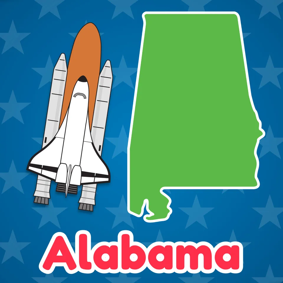
Football, rocket ships, festivals, and more!! Come learn all about Alabama!
Football, rocket ships, festivals, and more!! Come learn all about Alabama!
Part of
Standards alignment
Common Core State Standards
- D2.Geo.3.3-5 — Individually and with others, students… Use maps of different scales to describe the locations of cultural and environmental characteristics.
- D2.Civ.12.3-5 — Individually and with others, students… Explain how rules and laws change society and how people change rules and laws.
- D2.Civ.14.3-5 — Individually and with others, students… Illustrate historical and contemporary means of changing society.
- D2.Geo.2.3-5 — Individually and with others, students… Use maps, satellite images, photographs, and other representations to explain relationships between the locations of places and regions and their environmental characteristics.
Alabama
- SS10.1.4 — Identify contributions of diverse significant figures that influenced the local community and state in the past and present. (Alabama)
- SS10.1.5 — Identify historical events and celebrations within the local community and throughout Alabama. (Alabama)
- SS10.3.1.1 — Using cardinal and intermediate directions to locate on a map or globe an area in Alabama or the world (Alabama)
- SS10.4.14.1 — Recognizing important persons of the modern Civil Rights Movement, including Martin Luther King, Jr.; George C. Wallace; Rosa Parks; Fred Shuttlesworth; John Lewis; Malcolm X; Thurgood Marshall; Hugo Black; and Ralph David Abernathy
Alaska
- SL.CC.1 — Prepare for and participate effectively in a range of conversations and collaborations with diverse partners, building on others' ideas and expressing their own clearly and persuasively.
- SL.CC.2 — Integrate and evaluate information presented in diverse media and formats, including visually, quantitatively, and orally.
Arizona
- 2.G1.1 — Use and construct maps, graphs, and other geographic representations of familiar and unfamiliar places in the world; and locate physical and human features. • Key physical features include but are not limited to seven continents, oceans, lakes, rivers, mountain ranges, coasts, seas, and deserts • Key human features include but are not limited to equator, hemispheres, North and South Pole, cities, states, countries, regions, and landmarks
- 1.H4.2 — Draw upon fictional stories, biographies, and non-fiction/informational text to identify historical figures in your community, state, and nation and explain their significance in history and in the present day.
- 2.G1.2 — Use maps, globes, and other simple geographic models to identify and explain cultural and environmental characteristics of places in the world based on stories shared. Arizona History and Social Science Standards modified 8/23/19 Page 19
Arkansas
- G.1.1.2 — Describe the physical and human characteristics of a place including roads, buildings, and borders using maps, globes, and photographs.
- H.1.3.4 — Analyze individuals, groups, and events to understand why their contributions are important to the heritage of the United States and Arkansas • Indigenous peoples such as the Caddo*, Quapaw*, Osage*, and Cherokee* • Harriet Tubman* • Clara Barton • Rosa Parks* • Eleanor Roosevelt* • Dr. Martin Luther King, Jr.*
- H.1.K.4 — Recognize historic figures and other people who have made an impact on history.
- G.1.K.9 — Discuss products and traditions that connect people around the world (e.g., where products are made, celebrations, dance, art, food, toys).
California
- 3.4.6 — Describe the lives of American heroes who took risks to secure our freedoms (e.g., Anne Hutchinson, Benjamin Franklin, Thomas Jefferson, Abraham Lincoln, Frederick Douglass, Harriet Tubman, Martin Luther King, Jr.).
- 1.5.3 — Compare the beliefs, customs, ceremonies, traditions, and social practices of the varied cultures, drawing from folklore.
Colorado
- SS.1.4.2 — Identify and explain how the significance of notable people, places, holidays, and civic symbols reflect the origins and values of the government and its citizens.
- SS.5.2.1 — Use geographic tools and sources to research and answer questions about United States geography.
- SS.P.2.1 — Develop spatial understanding, perspectives, and connections to the world
Connecticut
- CIV 4.1 — Illustrate historical and contemporary means of changing society.
- GEO 3.2 — Use maps, satellite images, photographs, and other representations to explain relationships between the locations of places and regions and their environmental characteristics.
- GEO 3.3 — Use maps of different scales to describe the locations of cultural and environmental characteristics.
Delaware
- G.1.4-5a — Students will demonstrate development of mental maps of Delaware and of the United States which include the relative location and characteristics of major physical features, political divisions, and human settlements. Grade 4
- H.4.K-3b — Students will develop an awareness of major events and people in United States and Delaware history. • Who lives here and how did they get here? (immigrants, demographics, ethnic and religious groups) • Important people in our past • Different kinds of communities in Delaware and the United States
- G.1.K-3a — Students will understand the nature and uses of maps, globes, and other geo-graphics. Grade K and Grade 3
- H.4.4-5b — Students will develop an understanding of selected themes in United States history, including: • Who are the American people? (demographics, immigration) • How did the United States develop its form of government? • How have advances in technology changed our lives? • Important people in American history
Florida
- SS.3.AA.1.1 — Identify African Americans who demonstrated heroism and patriotism (e.g., Booker T. Washington, Jesse Owens, Tuskegee Airmen, Martin Luther King Jr., Rosa Parks, President Barack Obama, 1st Lt. Vernon Baker, Sgt. 1st Class Melvin Morris).
- SS.3.G.2.3 — Label the states in each of the five regions of the United States.
- SS.3.G.2.5 — Identify natural and man-made landmarks in the United States, Canada, Mexico, and the Caribbean.
- SS.1.A.2.4 — Identify people from the past who have shown character ideals and principles including honesty, courage, and responsibility.
Georgia
- SS5H6.b — Explain the key events and people of the Civil Rights movement: Brown v. Board of Education (1954), Montgomery Bus Boycott, the March on Washington, Civil Rights Act, Voting Rights Act, and civil rights activities of Thurgood Marshall, Lyndon B. Johnson, Cesar Chavez, Rosa Parks, and Martin Luther King, Jr.
Hawaii
- SS.1.3.17.1 — Investigate historically significant events, people, and observances in history
- SS.1.1.13.3 — Use maps and map features to describe places
- SS.2.1.7.2 — Describe how historical figures exemplify our shared democratic values
- SS.3.1.8.1 — Explore how people can change rules and laws, and how these changes affect society
Idaho
- 5.SS.1.1.2 — Discuss significant individuals who have been responsible for bringing about cultural and social changes in the United States.
- 2.SS.2.1.4 — Illustrate that boundary lines separate states.
- 2.SS.4.3.2 — Identify historic and contemporary people who model characteristics of good citizenship.
- 5.SS.2.1.4 — Name and locate the 50 States and their Capitals, and U.S. Territories.
Illinois
- SS.1.H.2 — Generate questions and investigate diverse individuals and groups who have shaped a significant historical change.
- SS.2.G.1 — With guidance and support, use print and digital maps, globes and other simple geographic models to identify cultural and environmental characteristics of places.
- SS.3.G.1 — Use print and digital maps, globes, and other simple geographic models to identify topographic and other graphic representations of both familiar and unfamiliar locations.
- SS.2.G.2 — With guidance and support, identify some cultural and environmental characteristics of your community and compare to other places or regions.
Indiana
- 5.G.2 — Use maps and globes to locate states, capitals, major cities, major rivers, the Great Lakes, and mountain ranges in the United States. (E)
- K.H.2 — Identify ways by which people, heritage, and events are commemorated and recognized. (E)
Iowa
- SS.5.12 — Describe how laws, rules and processes have changed over time in order to restrict, protect, or extend rights. (21st century skills)
- SS.5.9 — Analyze the strategies that a variety of demographic groups have used to ensure their rights.
Kansas
- Benchmark 3.3.1 — The student will recognize and evaluate how societies are shaped by the identities, beliefs, and practices of individuals and groups.
- Benchmark 4.5.1 — The student will recognize and evaluate dynamic relationships that impact lives in communities, states, and nations.
- Benchmark 5.2.1 — The student will recognize and evaluate the rights and responsibilities of people living in societies.
Kentucky
- 1.C.KGO.2 — Investigate how civic identity is shaped by symbolic figures, places and events.
Louisiana
- 1.8 — Identify examples of Louisiana's culture, including: a. State and nationally designated holidays: New Year’s Day, the birthday of Martin Luther King, Jr., Inauguration Day, Washington’s Birthday, Mardi Gras, Memorial Day, Juneteenth, Independence Day, Labor Day, Columbus Day, Veterans Day, Thanksgiving Day, and Christmas Day b. Music: Cajun, jazz, zydeco c. Languages: French, Spanish, Native languages (e.g., Atakpan, Caddo, Choctaw) d. Architecture: St. Louis Cathedral, The Cabildo, State Capitol, Louisiana Superdome, Strand Theater, Sports Hall of Fame, The National WWII Museum e. Traditions: lagniappe, second line parades, king cake, red beans and rice on Mondays f. Cuisine: jambalaya, gumbo, etouffee, bread pudding, meat pies, tamales g. Symbols: Louisiana State flag, brown pelican, magnolia tree, brown bear h. Individuals who have made significant contributions to Louisiana’s artistic heritage.
- 3.6 — Identify and describe national historical figures, celebrations, and symbols. a. Describe the achievements of George Washington, Thomas Jefferson, Lewis and Clark, Sacagawea, Abraham Lincoln, Frederick Douglass, Harriet Tubman, Sojourner Truth, Sitting Bull, George Washington Carver, Susan B. Anthony, Mabel Ping-Hua Lee, Theodore Roosevelt, the Wright Brothers, Thomas Edison, Henry Ford, Alexander Graham Bell, Dr. Martin Luther King Jr., Jackie Robinson, Sally Ride, Katherine Johnson, and Mae Jemison. b. Describe the significance of state and nationally designated holidays, including New Year’s Day, the birthday of Martin Luther King, Jr., Inauguration Day, Washington’s Birthday, Mardi Gras, Memorial Day, Juneteenth, Independence Day, Labor Day, Columbus Day, Veterans Day, Thanksgiving Day, Christmas Day. c. Describe the history of American symbols, including the Liberty Bell, U.S. flag (etiquette, customs pertaining to the display and use of the flag), bald eagle, national anthem, Uncle Sam, Statue of Liberty, The Pledge of Allegiance, and the national motto “In God We Trust.” d. Identify and describe man-made American monuments and landmarks including the Gateway Arch, the Golden Gate Bridge, Jefferson Memorial, Dr. Martin Luther King Jr. Memorial in Washington D.C, Lincoln Memorial, Mount Rushmore, Pearl Harbor Museum, September 11 Memorial and Museum, Statue of liberty, the Tomb of the Unknown Soldier, U.S. Capitol, Washington Monument, and the White House. e. Identify and describe natural American landmarks, including the Grand Canyon, Mississippi River, Monument Valley, Niagara Falls, Rocky Mountains, Smoky Mountains, and Yellowstone National Park.
- 3.7 — Describe the significance of major events in the history of the United States, including the American Revolution, Louisiana Purchase, Lewis and Clark Expedition, the abolition of slavery following the Civil War, women’s suffrage movement, civil rights movement, and the Space Race.
- 3.21 — Interpret geographic features of the United States using a variety of tools such as different types of maps and photos.
Maine
- F2 — Identifying the major regions of the Earth and their major physical features and political boundaries using a variety of geographic tools including digital tools and resources. *
- F2 — Identifying major historical eras, major enduring themes, turning points, events, consequences, and people in the history of Maine, the United States and various regions of the world. *
Maryland
- locating Maryland using cardinal directions on maps, globes, GPS, and/or Google Earth.
- identifying continents and oceans near and far from Maryland on maps and globe.
Massachusetts
- 4.T4b.1 — On a political map of the United States, locate the states and the national capital city in the Southeast, and the U.S. territories in the Caribbean; add to the timeline the admission dates for states in the Southeast (listed alphabetically: Alabama-1819, Arkansas-1836, Delaware-1787, Florida-1845, Georgia-1788, Kentucky-1792, Louisiana-1812, Maryland-1788, Mississippi-1817, North Carolina-1789, South Carolina-1788, Tennessee-1796, Virginia-1788, West Virginia-1863); territories Puerto Rico, and the United States Virgin Islands.
- 5.T5.8 — Research and analyze one of the people, organizations, events, or legislative acts from the 20th century that contributed to expanding civil rights of African Americans, women, and others in the United States.
Michigan
- 4–G1.0.1 — Identify questions geographers ask in examining the United States.
- 4–G1.0.3 — Use geographic tools and technologies, stories, songs, and pictures to answer geographic questions about the United States.
- 4–G2.0.2 — Locate and describe human and physical characteristics of major U.S. regions and compare them to the Great Lakes region.
Minnesota
- 3.3.1.1.1 — Use maps and concepts of location (relative location words and cardinal and intermediate directions) to describe places in one’s community, the state of Minnesota, the United States or the world. For example: Relative location words— close to, above, bordering. Description using relative location words—"Our school is across from the post office." Description using cardinal directions— "Mexico is south of the United States." Description using intermediate directions—“Hawaii is southwest of the continental United States.”
- 4.3.2.4.1 — Name and locate states and territories, major cities and state capitals in the United States.
- 4.3.2.3.1 — Locate and identify the physical and human characteristics of places in the United States, and also Canada or Mexico. For example: Physical characteristics—landforms (Rocky Mountains), ecosystems (forest), bodies of water (Mississippi River, Hudson Bay), soil, vegetation, weather and climate. Human characteristics— structures (Statue of Liberty), bridges (Golden Gate Bridge), canals (Erie Canal), cities, political boundaries, population distribution, settlement patterns, language, ethnicity, nationality, religious beliefs.
Mississippi
- 1.H.1.2 — Examine the significant contributions of historical figures to the local community, state, and United States.
- 2.G.1.2 — Identify political and physical borders in the United States and across the globe.
- 5.10.2 — Identify and label each of the 50 states on a map.
- 4.MS.8.2 — Identify important figures of the modern Civil Rights Movement including Mississippians (e.g., Martin Luther King Jr., Rosa Parks, Medgar Evers, James Meredith, Fannie Lou Hamer, Charles Evers, etc.).
Missouri
- 4.EG.5.B.a — Name and locate specific regions, states, capitals, river systems and mountain ranges in the United States based on historical or current topics.
- 5.H.3.C.a — Identify and describe the contributions of historically significant individuals to the United States from c. 1800-2000.
- 5.EG.5.B.a — Name and locate specific regions, states, capitals, river systems and mountain ranges in the United States based on historical or current topics.
- 4.EG.5.C.b — Identify and compare diverse human geographic characteristics of the nation.
Montana
- SS.G.5.1 — identify and label US regions, territories, states and their capitals/major cities;
- SS.G.3.1 — examine maps and other representations to identify historical and contemporary political and cultural patterns in the Americas;
- SS.H.5.3 — identify roles of individuals and groups and their impact on United States and tribal historical events;
- SS.G.3.3 — identify landforms and other physical characteristics of the Americas.
Nebraska
- SS 5.3.1.a — Use maps and atlases to locate major human and physical features in the United States.
- SS 1.4.3.a — Identify the contributions of historical people.
- SS 3.3.1.d — Locate specific places on maps and globes.
- SS 1.1.2.d — Compare and contrast historical and current government figures that exemplify civic engagement.
Nevada
- SS.2.15 — Discuss the contributions and positive impacts of culturally, racially, and ethnically diverse people in U.S. history.
- SS.2.21 — Identify major national landmarks associated with historical events.
- SS.5.19 — Discuss the contributions of culturally, racially, and ethnically diverse people to the advancement of the nation.
New Hampshire
- SS.GE.2.1.3 — Identify major physical and human features in the United States and on Earth, e.g., cities, oceans, or continents. (Themes: C: People, Places and Environment, G: Science, Technology, and Society)
- SS.HI.2.3.1 — Identify individuals and/or groups who have profoundly affected life in the United States, e.g., Abraham Lincoln, or Pilgrims. (Themes: H: Individualism, Equality and Authority, I: Patterns of Social and Political Interaction, J: Human Expression and Communication)
- SS.GE.6.2.2 — Describe how places and regions preserve culture, e.g., songs or traditions. (Themes: E: Cultural Development, Interaction, and Change, J: Human Expression and Communication)
- SS.HI.4.3.1 — Explore how individuals' ideals have profoundly affected life in the United States, e.g., Martin Luther King Jr.'s belief in nonviolence or John Stark's statement “Live Free or Die”. (Themes: H: Individualism, Equality and Authority, I: Patterns of Social and Political Interaction, J: Human Expression and Communication)
- SS.WH.6.5.4 — Examine forms of entertainment and leisure time activity, e.g., religious festivals, sporting events, or theatre. (Themes: E: Cultural Development, Interaction, and Change, J: Human Expression and Communication)
New Jersey
- 6.1.5.CivicsCM.1 — Use a variety of sources to describe the characteristics exhibited by real and fictional people that contribute(d) to the well-being of their community and country.
- 6.1.5.CivicsDP.2 — Compare and contrast responses of individuals and groups, past and present, to violations of fundamental rights (e.g., fairness, civil rights, human rights).
- 6.1.5.CivicsHR.2 — Research and cite evidence for how the actions of Dr. Martin Luther King, Jr. and other historical civil rights leaders served as catalysts for social change, inspired social activism in subsequent generations.
- 6.1.5.GeoSV.2 — Use maps to explain the impact of location and place on the relationships between places in New Jersey, the United States and other countries.
- 6.1.5.GeoPP.1 — Compare and contrast characteristics of regions in the United States based on culture, economics, and physical characteristics to understand the concept of regionalism.
New Mexico
- 1.13 — Investigate significant events, people, and observances in history and discuss their effects on local and national communities.
- 1.18 — Use a variety of maps to locate specific places and identify major landforms, bodies of water, and other places of significance around the United States.
- 5.27 — Using a map, identify and locate the 50 states in the United States and know the capitals of each state along with the surrounding U.S. territories.
New York
- E.1.3 — Study about the major social, political, economic, cultural, and religious developments in New York State and United States history involves learning about the important roles and contributions of individuals and groups.
- E.3.1 — Geography can be divided into six essential elements which can be used to analyze important historic, geographic, economic, and environmental questions and issues. These six elements include: the world in spatial terms, places and regions, physical settings (including natural resources), human systems, environment and society, and the use of geography. (Adapted from The National Geography Standards, 1994: Geography for Life)
- E.3.2 — Geography requires the development and application of the skills of asking and answering geographic questions; analyzing theories of geography; and acquiring, organizing, and analyzing geographic information. (Adapted from: The National Geography Standards, 1994: Geography for Life)
- E.1.2 — Important ideas, social and cultural values, beliefs, and traditions from New York State and United States history illustrate the connections and interactions of people and events across time and from a variety of perspectives.
North Carolina
- 2.H.1.1 — Summarize contributions of various women, indigenous, religious, racial, and other minority groups that have impacted American history.
- 2.G.1.1 — Recognize absolute and relative location of various settlements, territories, and states in the development of the American nation.
- 5.H.1.1 — Explain how the experiences and achievements of women, minorities, indigenous groups, and marginalized people have contributed to change and innovation in the United States
- K.G.1.1 — Use maps, globes, and/or digital representations to locate places in the classroom, school, community, and around the world.
- 2.C&G.1.4 — Explain how various indigenous, religious, gender, and racial groups advocate for freedom and equality.
Ohio
- 1.5 — Places are distinctive because of their physical characteristics (land forms and bodies of water) and human characteristics (structures built by people).
- 4.9 — A map scale and cardinal and intermediate directions can be used to describe the relative location of physical and human characteristics of Ohio and the United States.
Oklahoma
- 1.2.2 — Identify cardinal directions and use them to identify specific locations on a map.
- 1.2.5 — Describe community customs and traditions as basic elements of culture.
- 1.3.2 — Describe the contributions of people and groups who have shaped our history and ways we commemorate important places and events of the past.
- 4.2.5 — Identify and locate on a political map the fifty states and the United States capitol.
Oregon
- K.14 — Identify examples of unfairness or injustice towards individuals or groups and the “changemakers,” who worked to make the world better.
- 2.12 — Identify relative location of school and community in the state, nation and the world.
- 5.9 — Use geographical tools (maps, satellite images, photographs, Google Earth, and other representations) to investigate and compare how areas in the United States can be divided in multiple ways.
Pennsylvania
- 7.1.3.B — Identify and locate places and regions.
- 8.3.3.A. — Identify contributions of individuals and groups to United States history.
- 7.1.3.A — Identify geographic tools and their uses.
- 8.3.3.D. — Identify conflict and cooperation among social groups and organizations in United States history.
Rhode Island
- SS3.3.2 — States and territories in the Southeast Explain the states and territories that make up the Southeastern region including their admittance or incorporation to the United States and their identities
- SS3.3.4 — The Southeastern region today Argue how the geography and environment of the Southeastern region contributed to its social, cultural, and economic development
- SS3.1.3 — States and territories Explain what states and territories are and their locations within the United States
- SS3.3.1 — Geography and environment in the Southeast Explain the geography and environment in the Southeastern region of the United States
- SS2.4.5 — Creating Change Explain how people have brought social change to the world and ways students can contribute to positive change
South Carolina
- 3.1.3.PR — Identify the spatial hierarchy of political and physical geographic features. This indicator prompts students to inquire about spatial hierarchies (i.e. scale) to understand connections between Earth's systems. Political features include cities, states, and countries. Physical features include forests, mountains, oceans, and rivers.
- 2.G.3 — Explain how the distribution of human features, physical features, and natural resources within the U. S changes over time and impacts economic activity. This indicator was developed to encourage inquiry into how rivers, lakes, mountains, and other land features affect economic activity. This indicator also prompts students to explore how different geographic areas support different activities in different times due the availability of resources.
South Dakota
- 3.H.2.2 — Explain the importance of famous American figures including but not limited to George Washington, Abraham Lincoln, and Thomas Jefferson
- 3.G.1.2 — Locate the seven continents, four oceans, and major physical features and regions of the United States on a map or globe
- 4.G.1.1 — Locate major political and physical features of South Dakota and the United States on a map or globe
- K.H.2.1 — Identify local and national celebrations
Tennessee
- 2.29 — Examine the significant contributions made by people of the U.S., including: • Neil Armstrong • Martin Luther King, Jr. • Wilma Rudolph • David Crockett • Rosa Parks • Sequoyah • Benjamin Franklin • Jackie Robinson • George Washington
- 3.09 — Identify and locate the fifty states of the U.S.
- 1.12 — Use cardinal directions on a map.
Texas
- 1.3B — locate places using the four cardinal directions.
- 3.9B — identify figures such as Helen Keller, Clara Barton, and Ruby Bridges who exemplify good citizenship;
- 5.22A — identify the accomplishments of notable individuals in the fields of science and technology such as Benjamin Franklin, Eli Whitney, John Deere, Thomas Edison, Alexander Graham Bell, George Washington Carver, the Wright Brothers, and Neil Armstrong;
- 5.5C — identify the accomplishments and contributions of individuals and groups such as Susan B. Anthony, Martin Luther King Jr., Rosa Parks, Cesar Chavez, Franklin D. Roosevelt, Ronald Reagan, the Tuskegee Airmen, and the 442nd Regimental Combat Team in the areas of civil rights, women's rights, military actions, and politics.
- 5.6C — locate on a map important political features such as the five largest cities by population in the United States and the 50 states; and
- 1.14A — describe and explain the importance of beliefs, language, and traditions of families and communities; and
Utah
- 5.5.2.b — Identify leaders of social and political movements.
- 1.3.1.d — Identify the United States on a variety of maps and on a globe.
- 5.5.2.a — Identify major social movements of the 20th century (e.g. the women’s movement, the civil rights movement, child labor reforms).
Vermont
- D2.Geo.3.3-5 — Individually and with others, students… Use maps of different scales to describe the locations of cultural and environmental characteristics.
- D2.Civ.12.3-5 — Individually and with others, students… Explain how rules and laws change society and how people change rules and laws.
- D2.Civ.14.3-5 — Individually and with others, students… Illustrate historical and contemporary means of changing society.
Virginia
- 2.10.c — The student will describe the contributions and roles of changemakers in United States history including, but not limited to Reformers and Champions: Abraham Lincoln, Theodore Roosevelt, Helen Keller, Thurgood Marshall, Rosa Parks, Jackie Robinson, Cesar Chavez, Dr. Martin Luther King, Jr., Sen. Daniel Inouye, John F. Kennedy, and Barack Obama.
- 2.10.b — The student will describe the contributions and roles of changemakers in United States history including, but not limited to Explorers and Adventurers: Meriwether Lewis, William Clark, Sacagawea, Neil Armstrong, and Amelia Earhart.
- Skill.2.b — The student will apply history and social science skills to the content by applying geographic skills to identify and understand geographic features and connections.
- USI.1.c — The student will apply history and social science skills to understand the geography of North America by locating the 50 states.
Washington
- G1.3.2 — Investigate the physical, political, and cultural characteristics of places, regions, and people in North America, including the location of the fifty states within the regions of the United States.
- G1.3.1 — Examine and use maps and globes to understand the regions of North America in the past and present.
- G2.2.1 — Identify some common and unique cultural and environmental characteristics of specific places.
- H2.5.1 — Analyze and explain how individuals have caused change in United States history.
- G2.3.2 — Examine the cultural universals of place, time, family life, economics, communication, arts, recreation, food, clothing, shelter, transportation, government, and education.
Washington, D.C.
- 1.29 — Describe why some groups of people were treated unjustly in the past, and identify actions individuals took to promote greater equality and fairness in society.
- K.14 — Identify and describe the historic achievements and contributions of individuals with different abilities.
- K.4 — Identify individuals (historical or present-day) whose actions made the local or global community more just or fair and explain how their actions helped their community.
- 1.17 — Identify key political features of each region on a map, to include, local neighborhoods, wards, Washington, DC, the United States and North America.
West Virginia
- SS.2.16 — Explore the impact historic figures have had upon our society.
- SS.2.15 — Identify cultural contributions and differences made by people from the various regions in the United States using literature, documents and oral accounts.
- SS.2.19 — Locate county seats, the state's capital city, and bordering states on a map.
- SS.2.9 — Utilize a legend, compass rose and cardinal directions to identify locations (e.g., Charleston, West Virginia, New York, District of Columbia, etc.) and geographic features (e.g., Great Lakes, Rocky Mountains, Mississippi River, etc.) in the United States.
Wisconsin
- SS.Geog1.c.4-5 — Create and label a map (paper or digital) of the local community, state, tribal lands, and country, including both physical (e.g., oceans and continents) and human (e.g., roads, buildings) characteristics. Identify and construct regions (digital or paper) in Wisconsin and the United States.
- SS.PS1.a.K-1 — Describe symbols, songs, and traditions that identify our state and country. Assess the importance of rules and laws at home, in school, and in the community.
- SS.Geog2.d.4-5 — Summarize positive and negative factors of cities. Identify the location and patterns of cities within our state and country.
- SS.Hist2.b.i — Describe patterns of change over time in the community, state, and the United States.
Wyoming
- SS5.2.4 — Identify and describe positive and negative interactions (e.g., withholding of Native American U.S. citizenship until 1924), the tensions among cultural groups, social classes and/or significant individuals in Wyoming and the United States (e.g., Martin Luther King Jr., Helen Keller, Sacagawea, Chief Washakie, Chief Black Coal, Chief Pocatello, Chief Sharp Nose, and Chief Friday). RL.3.2, RL.4.7, RL.4.9 RI.3.3, RI.4.3, RI.5.3 W.3.2, W.3.7, W.4.2.b W.5.2.b W.5.7 SL.3.4 CV5.2.3
- SS2.5.1 — Spatial Use a map, globe, and mental mapping to identify familiar areas and simple patterns and create maps using various media. 2-ESS2-2
- SS5.5.1 — Spatial Apply mental mapping skills and use different representations of the Earth to demonstrate an understanding of human and physical patterns and how local decisions may create global impacts.
- SS5.5.3 — Human Place and Movement Describe the human features of an area (e.g., language, religion, political and economic systems, population distribution, and quality of life), past and present settlement patterns (e.g., Indigenous Tribes of Wyoming and the Oregon Trail), and how ideas, goods, and/or people move from one area to another. Benchmark_Component Sub-Item :SS5.5.3.a.i Human Place and Movement Describe how cultural values of the Indigenous Tribes of Wyoming influence the importance and preservation of place and sacred sites (e.g., Devils Tower/Bear Lodge, Hot Springs State Park, Vedauwoo, Crowheart Butte, Bighorn Medicine Wheel, Estes Park, Yellowstone, Heart Mountain, and Wind River Mountains). Benchmark_Component Sub-Item :SS5.5.3.a.ii Human Place and Movement Describe and identify a variety of place names and their connection to Indigenous Tribes of Wyoming. RL.3.2, RL.4.7, RL.4.9 RI.3.3, RI.4.3, RI.5.3 W.3.2, 3.7, 4.2.b, W.5.2.b, 5.7 SL.3.4
- SS5.5.2 — Physical Place and Region Explain how physical features, patterns, and systems impact different regions and how these features may help us generalize and compare areas within the reservation, state, nation, or world. RL.3.2, RL.4.7, RL.4.9 RI.3.3, RI.4.3, RI.5.3 W.3.2, W.3.7, W.4.2.b W.5.2.b W.5.7 SL.3.4