Nevada
Ages 5–11 · 13 minutes · Geography
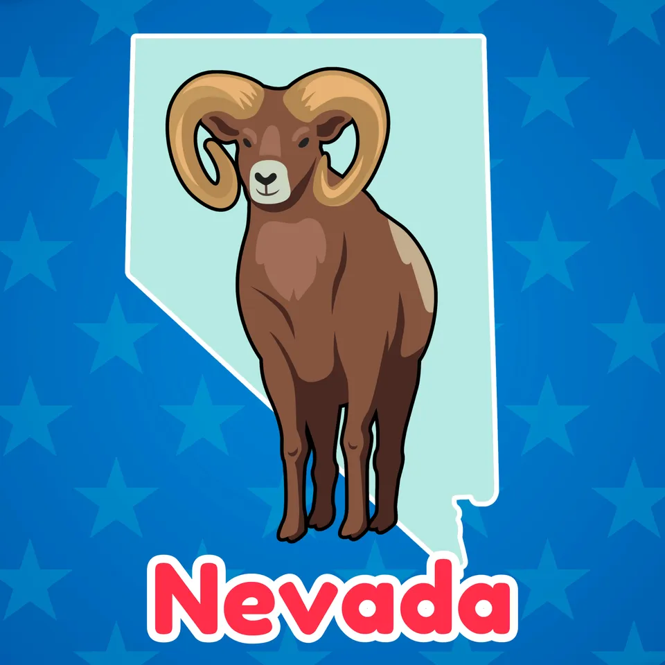
Nevada is never dull. In fact, it's full of silver and gold! Check out sights like the Hoover Dam and more.
Nevada has a ton of special sights! Come learn about Las Vegas, the Hoover Dam, Red Rock Canyon and more!
No prior knowledge needed.
Part of
Standards alignment
Common Core State Standards
- D2.Geo.6.K-2 — Individually and with others, students… Identify some cultural and environmental characteristics of specific places.
- D2.Geo.2.K-2 — Individually and with others, students… Use maps, graphs, photographs, and other representations to describe places and the relationships and interactions that shape them.
- D2.Geo.5.K-2 — Individually and with others, students… Describe how human activities affect the cultural and environmental characteristics of places or regions.
Alabama
- SS10.2.10 — Identify ways people throughout the country are affected by their human and physical environments.
- SS10.2.6 — Identify states, continents, oceans, and the equator using maps, globes, and technology.
- SS10.5.13.2 — Locating on a map states, capitals, and important geographic features west of the Mississippi River
- SS10.2.10.1 — Comparing physical features of regions throughout the United States
- SS10.2.10.3 — Recognizing benefits of recreation and tourism at state and national parks (Alabama)
Alaska
- 1 — know that places have distinctive geographic characteristics;
- 1 — use maps and globes to locate places and regions;
- 2 — understand the people and the political, geographic, economic, cultural, social, and environmental events that have shaped the history of the state, the United States, and the world;
Arizona
- 5.G1.1 — Use and construct maps and graphs to represent changes in the United States. • Key concepts include but are not limited to physical and human features of the United States, the regions of the United States and their characteristics, geographic location of major events, the growth of the United States through territorial expansion, demographic changes, and the states and their capitals
- 2.G1.1 — Use and construct maps, graphs, and other geographic representations of familiar and unfamiliar places in the world; and locate physical and human features. • Key physical features include but are not limited to seven continents, oceans, lakes, rivers, mountain ranges, coasts, seas, and deserts • Key human features include but are not limited to equator, hemispheres, North and South Pole, cities, states, countries, regions, and landmarks
- 1.G1.1 — Use, explore and construct maps, graphs and other geographical representations to support content focus. • Key concepts include but are not limited to physical features (rivers, lakes, mountains, landforms, desert) and human features (dams, cities, parks, hospitals, schools, railroad tracks, farms, factories, houses)
Arkansas
- C.1.2.3 — Explain the functions of government using local examples such as infrastructure, safety, and rules/laws.
- G.1.1.2 — Describe the physical and human characteristics of a place including roads, buildings, and borders using maps, globes, and photographs.
- H.1.2.5 — Explain state and national historical symbols and landmarks and the people and events associated with them.
California
- 3.1.2 — Trace the ways in which people have used the resources of the local region and modified the physical environment (e.g., a dam constructed upstream changed a river or coastline).
- 3.1.1 — Identify geographical features in their local region (e.g., deserts, mountains, valleys, hills, coastal areas, oceans, lakes).
Colorado
- SS.2.2.2 — Explain how people in communities manage, modify, and depend on their environment.
- SC.K.3.2 — Plants and animals meet their needs in their habitats and impact one another; people can prepare for severe weather.
- SS.2.2.1 — Use geographic terms and tools to locate and describe spatial patterns and places.
- SS.2.4.2 — Explain the roles and characteristics of people who govern different communities.
Connecticut
- GEO 2.6 — Identify cultural and environmental characteristics of a place/region.
- GEO 2.3 — Use geographic representations to identify cultural and environmental characteristics of place.
- GEO 2.5 — Explain how humans affect the culture and environment of places/region.
- GEO 3.4 — Explain how culture influences the way people modify and adapt to their environments.
Delaware
- G.1.4-5a — Students will demonstrate development of mental maps of Delaware and of the United States which include the relative location and characteristics of major physical features, political divisions, and human settlements. Grade 4
- G.3.K-3a — Students will identify types of human settlement, connections between settlements, and the types of activities found in each. Grade 3
- K-3a — Students will use the concepts of place and region to explain simple patterns of connections between and among places across the country and the world. Grade 3
- C.1.4-5a — Students will understand that governments have a variety of structures and exist for many purposes and that in America these are explained in the United States and State constitutions. Grade 4
- H.4.K-3b — Students will develop an awareness of major events and people in United States and Delaware history. • Who lives here and how did they get here? (immigrants, demographics, ethnic and religious groups) • Important people in our past • Different kinds of communities in Delaware and the United States
Florida
- SS.3.G.2.5 — Identify natural and man-made landmarks in the United States, Canada, Mexico, and the Caribbean.
- SS.5.G.1.6 — Locate and identify states, capitals, and United States Territories on a map.
- SS.3.G.3.2 — Describe the natural resources in the United States, Canada, Mexico, and the Caribbean.
Hawaii
- SS.1.2.14.3 — Investigate cultural and environmental characteristics of your community
- SS.1.3.17.1 — Investigate historically significant events, people, and observances in history
- SS.2.3.13.4 — Describe major geographic features of places using maps, photos, and other geographic representations
- SS.2.3.14.5 — Compare a variety of the Earth's natural resources and how people use them
- SS.2.1.6.1 — Investigate school, community, and national leaders and their responsibilities
Idaho
- 2.SS.2.1.1 — Identify landforms, bodies of water, and human made features such as cities and dams on a map and globe.
- 5.SS.2.1.4 — Name and locate the 50 States and their Capitals, and U.S. Territories.
- 1.SS.2.2.2 — Identify the ways people modify their environment.
- 5.SS.2.1.2 — Identify the regions of the United States and their resources.
Illinois
- SS.2.G.2 — With guidance and support, identify some cultural and environmental characteristics of your community and compare to other places or regions.
- SS.3.G.1 — Use print and digital maps, globes, and other simple geographic models to identify topographic and other graphic representations of both familiar and unfamiliar locations.
- SS.1.G.1 — With guidance and support, construct and interpret print and digital maps and other cultural representations of familiar places.
Indiana
- 5.G.2 — Use maps and globes to locate states, capitals, major cities, major rivers, the Great Lakes, and mountain ranges in the United States. (E)
- 5.G.5 — Identify major sources of accessible fresh water, and describe the impact of access on the local and regional communities.
Iowa
- Maps show where things are located. One can map the shapes and kinds of land and water in any area.
Kansas
- Benchmark 4.5.1 — The student will recognize and evaluate dynamic relationships that impact lives in communities, states, and nations.
- Standard 4.5 — Relationships among people, places, ideas, and environments are dynamic.
Kentucky
- 1.G.HE.1 — Describe ways people modify their environment.
- K.G.KGE.1 — Identify physical and environmental characteristics of communities.
- 2.G.GR.1 — Examine geographic features of places in North America, using a variety of geographic data, including maps, photos and other geographic tools.
Louisiana
- 3.25 — Describe why and how people in the United States have modified their environment.
- 3.20 — Describe the geographic features of places in the United States.
- 2.21 — Describe geographic features and physical characteristics of places in the United States and the world, including mountains, hills, plains, deserts, coasts, islands, peninsulas, lakes, oceans, and rivers.
Maine
- SL.3.K.a — Describe familiar people, places, things, and events and, with prompting and support, provide additional detail.
- Substructures have shapes and parts that serve functions.
Massachusetts
- 4.T4e.1 — On a political map of the United States, locate the states in the West and the U.S. territories in the Pacific Ocean; add to the timeline the admission dates for states in the Southwest (states listed alphabetically, Alaska-1959, California-1850, Colorado-1876, Hawaii-1959, Idaho-1890, Montana-1889, Nevada-1864, Oregon-1859, Utah-1896, Washington-1889, Wyoming-1890); territories: American Samoa, Guam, Midway Islands, Northern Mariana Islands, and Wake Island.
- 4.T4e.5 — Using resources such as print and online atlases, or state websites, construct a map of a state in the West region that provides information about physical features (e.g., waterways and mountains), important landmarks, national parks, and historic sites and that includes a title, scale, compass, and map key.
- RI.4.4 — Determine the meaning of general academic and domain-specific words or phrases in a text relevant to a grade 4 topic or subject area.
Michigan
- 4-G5.0.1 — Assess the positive and negative consequences of human activities on the physical environment of the United States and identify the causes of those activities.
- 4–G1.0.3 — Use geographic tools and technologies, stories, songs, and pictures to answer geographic questions about the United States.
Minnesota
- 2.3.1.1.3 — Use maps, photos or other geographic tools to identify and locate major landmarks or major physical features of the United States. For example: Physical features—the Atlantic Coast, Rocky Mountains, Mississippi River, Lake Superior. Landmarks—Statue of Liberty, Angel Island, Gateway Arch in St. Louis, Mount Rushmore, Crazy Horse Memorial.
- 4.3.2.4.1 — Name and locate states and territories, major cities and state capitals in the United States.
- 4.3.2.3.1 — Locate and identify the physical and human characteristics of places in the United States, and also Canada or Mexico. For example: Physical characteristics—landforms (Rocky Mountains), ecosystems (forest), bodies of water (Mississippi River, Hudson Bay), soil, vegetation, weather and climate. Human characteristics— structures (Statue of Liberty), bridges (Golden Gate Bridge), canals (Erie Canal), cities, political boundaries, population distribution, settlement patterns, language, ethnicity, nationality, religious beliefs.
Mississippi
- 3.CI.2.3 — Recognize locations where government is practiced at the national, state, and local levels.
- 5.10.2 — Identify and label each of the 50 states on a map.
- 5.9.2 — Identify school, community, state, and national symbols (e.g., United States flag, American eagle, etc.).
Missouri
- 2.H.3.C.a — Describe the contributions of inventors or pioneers in their field who influenced progress in our nation.
- 4.EG.5.B.a — Name and locate specific regions, states, capitals, river systems and mountain ranges in the United States based on historical or current topics.
- 5.EG.5.B.a — Name and locate specific regions, states, capitals, river systems and mountain ranges in the United States based on historical or current topics.
- 4.EG.5.C.a — Identify and compare physical characteristics of specific regions within the nation.
Montana
- SS.G.5.1 — identify and label US regions, territories, states and their capitals/major cities;
- SS.G.1.1 — identify and describe human and physical local landmarks; and
- SS.G.2.2 — describe how geography and human activities impact each other.
- SS.CG.2.1 — explain the roles of people who help govern different communities including tribal communities; and
Nebraska
- SS 1.3.3.c — Describe how people adapt to their physical environment.
- SS 3.3.1.d — Locate specific places on maps and globes.
- SS 5.3.1.a — Use maps and atlases to locate major human and physical features in the United States.
- SS 5.3.1 — Explore where (spatial) and why people, places, and environments are organized in the United States.
Nevada
- SS.4.19 — Identify the contributions of culturally, racially, and ethnically diverse individual Nevadans to the advancement of Nevada.
- SS.4.24 — Examine how and why Nevada’s landscape has been impacted by humans.
- SS.4.27 — Using historical and contemporary examples discuss the importance of major industries in Nevada’s economy.
- SS.4.14 — Evaluate the development and evolution of Nevada’s symbols, mottoes, and slogans.
- SS.4.28 — Describe the intended and unintended consequences of decisions made regarding limited and shared resources in Nevada.
New Hampshire
- SS.GE.2.1.3 — Identify major physical and human features in the United States and on Earth, e.g., cities, oceans, or continents. (Themes: C: People, Places and Environment, G: Science, Technology, and Society)
- SS.GE.2.2.2 — Recognize that areas of the Earth's surface share unifying geographic characteristics, e.g., towns, deserts or woodlands. (Themes: C: People, Places and Environment)
- SS.GE.4.1.3 — Locate major physical and human features in the United States and on Earth, e.g., mountain ranges, principal parallels or meridians. (Themes: C: People, Places and Environment, G: Science, Technology, and Society)
- SS.HI.4.4.2 — Explore the impact of important technological inventions, e.g., new forms of transportation or housing. (Themes: E: Cultural Development, Interaction, and Change, G: Science, Technology, and Society)
- SS.GE.2.3.2 — Explore the components and distribution of ecosystems, e.g., desert or rain forest. (Themes: C: People, Places and Environment)
New Jersey
- 6.1.2.Geo.HE.3 — Identify cultural and environmental characteristics of different regions in New Jersey and the United States.
- 6.1.5.GeoHE.2 — Cite examples of how technological advances have changed the environment in New Jersey and the United States (e.g., energy, transportation, communications).
- 6.1.5.CivicsPI.5 — Explain how government functions at the local, county, and state level.
New Mexico
- 5.27 — Using a map, identify and locate the 50 states in the United States and know the capitals of each state along with the surrounding U.S. territories.
- 1.18 — Use a variety of maps to locate specific places and identify major landforms, bodies of water, and other places of significance around the United States.
- 1.19 — Explain how human-made structures are all examples of how people modify the physical environment to meet needs and wants.
- K.10 — Identify the local, state, and national symbols (e.g., flag, bird, song).
New York
- 1.6b — Roads, dams, bridges, farms, parks, and dwellings are all examples of how people modify the physical environment to meet needs and wants.
- 1.4b — Governments exist at the local, state, and national levels to represent the needs of the people, create and enforce laws, and help resolve conflicts.
- 1.6 — People and communities depend on and modify their physical environment in order to meet basic needs.
- E.1.3 — Study about the major social, political, economic, cultural, and religious developments in New York State and United States history involves learning about the important roles and contributions of individuals and groups.
North Carolina
- 3.C&G.1 — Understand the structure and function of state and local government.
- K.G.1.1 — Use maps, globes, and/or digital representations to locate places in the classroom, school, community, and around the world.
- K.G.2.1 — Explain ways people around the world use natural resources.
- 5.G.1.1 — Explain the relationship between location, physical environment, and human activity in the United States.
Ohio
- 1.5 — Places are distinctive because of their physical characteristics (land forms and bodies of water) and human characteristics (structures built by people).
- 4.12 — People have modified the environment throughout history resulting in both positive and negative consequences in Ohio and the United States.
Oklahoma
- 4.2.2 — Identify major physical features in the United States and analyze how physical processes shape places. A. Identify and describe the physical characteristics of places, including the major landforms, bodies of water, vegetation and climates in the United States. B. Describe the location and characteristics of the major ecosystems in the United States.
- 4.2.5 — Identify and locate on a political map the fifty states and the United States capitol.
- 1.3.2 — Describe the contributions of people and groups who have shaped our history and ways we commemorate important places and events of the past.
- 4.4.2 — Describe the patterns and networks of economic interdependence among regions of the United States. A. Identify and locate on a map the major cities of the United States, including their relative location to natural resources and transportation routes. B. Identify the major economic activities of each region of the United States by comparing how people satisfy their basic needs through the production of goods and services. C. Describe the relative location of natural resources, such as fossil fuels, minerals and soils, and their relationship to each region’s major economic activities, including agriculture, manufacturing, transportation, energy, and services.
Oregon
- 2.12 — Identify relative location of school and community in the state, nation and the world.
- K.10 — Locate, identify and describe places of importance to self, family, school, and culture.
- 1.8 — Give examples of local natural resources and describe how people use them.
Pennsylvania
- 7.1.3.B — Identify and locate places and regions.
- 7.2.3.A — Identify the physical characteristics of places and regions.
- 7.3.3.E — Identify the human characteristics of places and regions by their political activities.
- 7.4.3.B — Identify the impacts of people on physical systems.
- 7.4.3.A — Identify the impacts of physical systems on people.
- 8.3.3.A. — Identify contributions of individuals and groups to United States history.
Rhode Island
- SS3.6.2 — States and territories in the West Explain the states and territories that make up the Western region including their admittance or incorporation to the United States and their identities
- SS3.6.4 — The Western region today Argue how the geography and environment of the Western region contributed to its social, cultural, and economic development
- SS3.6.1 — Geography and environment of the West Explain the geography and environment of the Western region of the United States
- SS3.1.3 — States and territories Explain what states and territories are and their locations within the United States
South Carolina
- 2.G.3 — Explain how the distribution of human features, physical features, and natural resources within the U. S changes over time and impacts economic activity. This indicator was developed to encourage inquiry into how rivers, lakes, mountains, and other land features affect economic activity. This indicator also prompts students to explore how different geographic areas support different activities in different times due the availability of resources.
- 3.1.3.PR — Identify the spatial hierarchy of political and physical geographic features. This indicator prompts students to inquire about spatial hierarchies (i.e. scale) to understand connections between Earth's systems. Political features include cities, states, and countries. Physical features include forests, mountains, oceans, and rivers.
- 3.2.2.ER — Identify and analyze the ways people interact with the physical environment in different regions of the state, the country, and the world.This indicator prompts students to inquire about a variety of geographic landforms, water bodies, and climate patterns around the world and how humans interact with them, including population distribution and settlement patterns.
- K-ESS2-2. — Construct an argument supported by evidence for how plants and animals (including humans) can change the environment to meet their needs. Clarification Statement: Examples of plants and animals changing their environment could include beavers building dams, a squirrel digging in the ground to hide its food, and tree roots breaking concrete. Humans have developed means to heat and/or cool our homes and vehicles to protect ourselves from the elements.
South Dakota
- 3.G.1.2 — Locate the seven continents, four oceans, and major physical features and regions of the United States on a map or globe
- 4.G.1.1 — Locate major political and physical features of South Dakota and the United States on a map or globe
- K.G.1.1 — Recognize that maps and globes represent places
Tennessee
- 3.13 — Explain how geographic challenges are met with: • Bridges • Irrigation systems • Canals • Landfills • Dams • Tunnels • Freshwater supply
- 3.09 — Identify and locate the fifty states of the U.S.
- SSP.06 — Develop geographic awareness by: • Identifying geographic symbols on maps and globes • Understanding relationships between people, places, and resources
Texas
- 2.1B — identify and explain the significance of various community, state, and national landmarks such as monuments and government buildings.
- 1.15C — identify the contributions of scientists and inventors such as Alexander Graham Bell, Thomas Edison, and Garrett Morgan.
- 1.5A — identify and describe the physical characteristics of place such as landforms, bodies of water, Earth's resources, and weather; and
- 2.11D — identify symbols such as state and national birds and flowers and Uncle Sam; and
- 2.4B — locate places, including the local community, Texas, the United States, the state capital, the U.S. capital, and the bordering countries of Canada and Mexico on maps and globes.
Vermont
- D2.Geo.6.K-2 — Individually and with others, students… Identify some cultural and environmental characteristics of specific places.
- D2.Geo.2.K-2 — Individually and with others, students… Use maps, graphs, photographs, and other representations to describe places and the relationships and interactions that shape them.
- D2.Geo.9.K-2 — Individually and with others, students… Describe the connections between the physical environment of a place and the economic activities found there.
Virginia
- USI.1.c — The student will apply history and social science skills to understand the geography of North America by locating the 50 states.
Washington
- G1.3.2 — Investigate the physical, political, and cultural characteristics of places, regions, and people in North America, including the location of the fifty states within the regions of the United States.
- G2.2.1 — Identify some common and unique cultural and environmental characteristics of specific places.
- G1.2.3 — Use maps, graphs, photographs and other representations to describe places and the relationships and interactions that shape them.
Washington, D.C.
- 1.18 — Compare the features of a city, county, state, country and continent.
- 1.17 — Identify key political features of each region on a map, to include, local neighborhoods, wards, Washington, DC, the United States and North America.
- 2.8 — Analyze artifacts –– such as photographs, renderings, petroglyphs, cave dwellings, etc. –– and text-based sources to explain how historians learn about the past.
West Virginia
- SS.3.13 — Distinguish between a continent, country, state and capital.
- SS.4.10 — Compare and contrast the physical, economic and political changes to America caused by geographic conditions and human intervention (e.g., bridges, canals, state boundaries, transportation, etc.).
- SS.5.17 — Compare and contrast the various regions of the United States; locate each of the fifty United States and correlate them with their regions.
- Use maps, graphs, photographs, and other representations to describe places.
Wisconsin
- SS.Geog1.b.1-2 — Identify physical and human characteristics of a place using maps, graphs, photographs, and other representations.
- SS.Geog4.a.4 — Describe how certain places may have meanings that distinguish them from other places (e.g., cemetery, places of worship, state or national parks, historical park, or battlefield). Compare and contrast the human characteristics of rural, suburban, urban, and tribal locations in Wisconsin and the United States. Identify and describe how people may view places in the community differently (e.g., students and senior citizens responding to a new playground).
- SS.Geog5.b.5 — Examine how human actions modify the physical environment when using natural resources (renewable and nonrenewable).
- SS.PS3.c.1 — Compare basic political institutions (e.g., what a government is and how it differs at the city, state, tribal, country, and global level), and the roles they serve in their lives and in the lives of others (e.g., make laws, create order).
- SS.Geog5.b.2 — Identify natural resources (e.g., fertile soil, forests, mining) of a place and provide examples of how those resources are used.
Wyoming
- SS2.5.2 — Physical Place and Region Identify, describe, and use local physical and human characteristics to discuss the similarities and differences between parts of the community (e.g., neighborhoods, schools, towns, and reservation communities). RL.1.2, RL.2.3 RI.1.3, Rl.2.2, RI.2.10 W.K.2, W.K.7 W.1.1, W.1.7 W.2.1, W.2.7 SL.K.4, SL.1.4, SL.2.2
- SS2.5.3 — Human Place and Movement Use the human features of a community to describe what makes that community unique (e.g., cultural, language, religion, food, clothing, political, economic, population, and types of jobs in an area) and why others move to or from that place. RL.1.2, RL.2.3 RI.1.3, Rl.2.2, RI.2.10 W.K.2, W.K.7 W.1.1, W.1.7 W.2.1 W.2.7 SL.K.4, SL.1.4, SL.2.2 K-2-ETS1-1
- SS5.5.2 — Physical Place and Region Explain how physical features, patterns, and systems impact different regions and how these features may help us generalize and compare areas within the reservation, state, nation, or world. RL.3.2, RL.4.7, RL.4.9 RI.3.3, RI.4.3, RI.5.3 W.3.2, W.3.7, W.4.2.b W.5.2.b W.5.7 SL.3.4
- SS2.5.1 — Spatial Use a map, globe, and mental mapping to identify familiar areas and simple patterns and create maps using various media. 2-ESS2-2