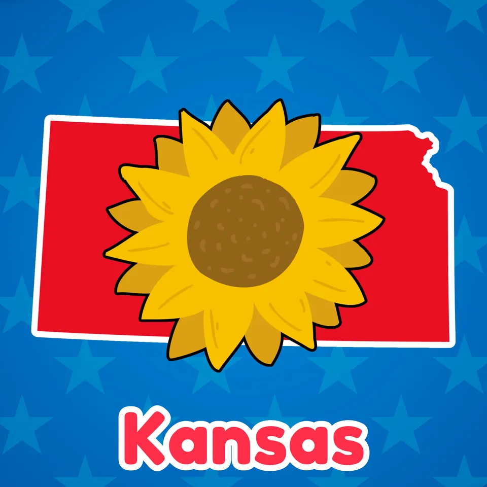
Kansas
Ages 5–11 · 14 minutes · Geography
There's no place like...Kansas! Come learn about tornadoes and more.
Come learn about the Kansas landscape, and save your appetite for some barbecue!
No prior knowledge needed.
Part of
Standards alignment
Common Core State Standards
- D2.Geo.4.K-2 — Individually and with others, students… Explain how weather, climate, and other environmental characteristics affect people’s lives in a place or region.
- D2.Geo.6.K-2 — Individually and with others, students… Identify some cultural and environmental characteristics of specific places.
- D2.Civ.5.K-2 — Individually and with others, students… Explain what governments are and some of their functions.
- D2.Geo.12.K-2 — Individually and with others, students… Identify ways that a catastrophic disaster may affect people living in a place.
- D2.Geo.3.K-2 — Individually and with others, students… Use maps, globes, and other simple geographic models to identify cultural and environmental characteristics of places.
Alabama
- SS10.5.13.2 — Locating on a map states, capitals, and important geographic features west of the Mississippi River
- SS10.6.4.3 — Describing the emergence of the modern woman during the early 1900s
- SS10.7G.10.1 — Identifying types, locations, and characteristics of natural hazards, including earthquakes, hurricanes, tornadoes, and mudslides
Alaska
- K-ESS3-1 — Use a model to represent the relationship between the needs of different plants and animals (including humans) and the places they live.
- Living things affect the physical characteristics of their regions.
Arizona
- 2.G1.1 — Use and construct maps, graphs, and other geographic representations of familiar and unfamiliar places in the world; and locate physical and human features. • Key physical features include but are not limited to seven continents, oceans, lakes, rivers, mountain ranges, coasts, seas, and deserts • Key human features include but are not limited to equator, hemispheres, North and South Pole, cities, states, countries, regions, and landmarks
- 2.G1.2 — Use maps, globes, and other simple geographic models to identify and explain cultural and environmental characteristics of places in the world based on stories shared. Arizona History and Social Science Standards modified 8/23/19 Page 19
- K.SL.4 — Describe familiar people, places, things, and events and, with prompting and support, provide additional detail.
- K.SL.2 — Confirm understanding of a text read aloud or information presented orally or through other media by asking and answering questions about key details and requesting clarification if something is not understood.
Arkansas
- G.1.K.2 — Identify and describe the physical characteristics of a place such as rivers, mountains, and forests using maps, globes, and photographs.
- H.1.K.4 — Recognize historic figures and other people who have made an impact on history.
- K-ESS3-1 — Use a model to represent the relationship between the needs of different plants or animals (including humans) and the places they live.
- K.RC.4.RF — Build general and academic vocabulary and background knowledge of age and grade-appropriate topics through discussion, reading, and writing.
- Some kinds of severe weather are more likely than others in a given region. Weather scientists forecast severe weather so that the communities can prepare for and respond to these events.
California
- 2 — Students identify the human and physical characteristics of the places they are studying and explain how those features form the unique character of those places.
Colorado
- SS.1.2.1 — Use geographic terms and tools to describe places and spaces.
- SS.2.2.1 — Use geographic terms and tools to locate and describe spatial patterns and places.
- SC.K.3.2 — Plants and animals meet their needs in their habitats and impact one another; people can prepare for severe weather.
Connecticut
- GEO 4.2 — Use maps, satellite images, photographs, and other representations to explain relationships between the locations of places and regions and their environmental characteristics
- K-ESS3-1 — Use a model to represent the relationship between the needs of different plants and animals (including humans) and the places they live.
Delaware
- G.2.K-3a — Students will distinguish different types of climate and landforms and explain why they occur. Grade 2
- G.1.K-3a — Students will understand the nature and uses of maps, globes, and other geo-graphics. Grade K and Grade 3
- K-3a — Students will use the concepts of place and region to explain simple patterns of connections between and among places across the country and the world. Grade 3
- K-ESS3-1 — Use a model to represent the relationship between the needs of different plants and animals (including humans) and the places they live.
Florida
- SS.5.G.1.6 — Locate and identify states, capitals, and United States Territories on a map.
- SS.K.CG.1.2 — Identify people who have the authority and power to make and enforce rules and laws.
- SS.K.G.3.1 — Identify basic landforms.
- SS.3.G.2.5 — Identify natural and man-made landmarks in the United States, Canada, Mexico, and the Caribbean.
Georgia
- S3L1.c — Use evidence to construct an explanation of why some organisms can thrive in one habitat and not in another.
Hawaii
- SS.2.1.18.3 — Describe how significant people and events have shaped communities and
- SS.2.3.13.4 — Describe major geographic features of places using maps, photos, and other geographic representations
- K-ESS3-1 — Use a model to represent the relationship between the needs of different plants and animals (including humans) and the places they live.
Idaho
- Living things need water, air, and resources from the land. They live in places that have the things they need. (K-ESS-2.1)
- Some kinds of weather are more likely than others in a given region. Weather scientists forecast the weather so that local communities can prepare for and respond to these events. (K-ESS-2.2)
- 5.SS.2.1.4 — Name and locate the 50 States and their Capitals, and U.S. Territories.
- Plants and animals can change their environment. (K-ESS-1.2)
Illinois
- SS.2.G.2 — With guidance and support, identify some cultural and environmental characteristics of your community and compare to other places or regions.
- SS.2.G.1 — With guidance and support, use print and digital maps, globes and other simple geographic models to identify cultural and environmental characteristics of places.
- SS.K.G.1 — With guidance and support, explain how weather, climate and other environmental factors affect people's lives and cultural identities in our region.
- ESS2.E-P1 — Plants and animals can change their environment.
Indiana
- 5.G.2 — Use maps and globes to locate states, capitals, major cities, major rivers, the Great Lakes, and mountain ranges in the United States. (E)
- 2.ESS.2 — Investigate the severe weather of the region and its impact on the community, looking at forecasting to prepare for, and respond to, severe weather.
- 3.G.2 — Label a map of the Midwest, identifying states, major rivers, lakes, and the Great Lakes. (E)
- K.LS.3 — Use observations to describe patterns of what plants and animals (including humans) need to survive.
Iowa
- K-ESS3-1 — Use a model to represent the relationship between the needs of different plants and animals (including humans) and the places they live.
- SS.K.14. — Compare environmental characteristics in Iowa with other places.
- Interpret Processes, Rules and Laws
- SS.K.9. — Compare and contrast rules from different places. (21st century skills)
Kansas
- Benchmark 4.5.1 — The student will recognize and evaluate dynamic relationships that impact lives in communities, states, and nations.
- Standard 4.5 — Relationships among people, places, ideas, and environments are dynamic.
- K-ESS3-1 — Use a model to represent the relationship between the needs of different plants and animals (including humans) and the places they live.
Kentucky
- K.G.KGE.1 — Identify physical and environmental characteristics of communities.
- Plants and animals can change their environment.
Louisiana
- 2.21 — Describe geographic features and physical characteristics of places in the United States and the world, including mountains, hills, plains, deserts, coasts, islands, peninsulas, lakes, oceans, and rivers.
- 3-LS2-1 — Construct an argument that some animals form groups that help members survive.
- K-ESS3-1 — Use a model to represent the relationship between the needs of different plants and animals (including humans) and the places they live.
Maine
- K-ESS3-1 — Use a model to represent the relationship between the needs of different plants and animals (including humans) and the places they live.
- K-ESS2-2 — Construct an argument supported by evidence for how plants and animals (including humans) can change the environment to meet their needs.
Maryland
- K-ESS3-1 — Use a model to represent the relationship between the needs of different plants and animals (including humans) and the places they live.
- DCI.ESS2.B.K-2.1 — Maps show where things are located. One can map the shapes and kinds of land and water in any area.
- DCI.LS4.D.K-2.1 — There are many different kinds of living things in any area, and they exist in different places on land and in water.
Massachusetts
- 4.T4c.1 — On a political map of the United States, locate the states in the Midwest; add to the timeline the admission dates for states in the Midwest (listed alphabetically: Illinois-1818, Indiana-1816, Iowa-1846, Kansas-1861, Michigan-1838, Minnesota-1858, Missouri-1821, Nebraska-1867, North Dakota-1889, Ohio-1803, South Dakota-1889, Wisconsin-1848).
- 4.T4c.3 — Explain how natural disasters, such as tornadoes and drought, have affected the region, and how government and citizens have responded to catastrophic natural events.
Michigan
- 4–G1.0.3 — Use geographic tools and technologies, stories, songs, and pictures to answer geographic questions about the United States.
- 4–G2.0.2 — Locate and describe human and physical characteristics of major U.S. regions and compare them to the Great Lakes region.
- 4–G2.0.1 — Describe ways in which the United States can be divided into different regions.
Minnesota
- 4.3.2.3.1 — Locate and identify the physical and human characteristics of places in the United States, and also Canada or Mexico. For example: Physical characteristics—landforms (Rocky Mountains), ecosystems (forest), bodies of water (Mississippi River, Hudson Bay), soil, vegetation, weather and climate. Human characteristics— structures (Statue of Liberty), bridges (Golden Gate Bridge), canals (Erie Canal), cities, political boundaries, population distribution, settlement patterns, language, ethnicity, nationality, religious beliefs.
- 4.3.2.4.1 — Name and locate states and territories, major cities and state capitals in the United States.
- 0L.1.2.1.2 — Make observations of plants and animals to compare the diversity of life in different habitats. (P: 3, CC: 1, CI: LS4)
- 2.3.1.1.4 — Use maps, photos, or other geographic tools to answer basic questions about where people are located. For example: Where are we? What is this location like? What are the characteristics of this location? How has this place been affected by the movement of people, goods and ideas? How do people modify the environment to fit their needs? How do people organize locations into regions? How is this place similar to or different from other places?
Mississippi
- 5.10.2 — Identify and label each of the 50 states on a map.
- L.1.4.1 — Explore the cause and effect relationship between plant adaptations and environmental changes (i.e., leaves turning toward the sun, leaves changing color, leaves wilting, or trees shedding leaves).
Missouri
- 4.EG.5.B.a — Name and locate specific regions, states, capitals, river systems and mountain ranges in the United States based on historical or current topics.
- 4.EG.5.F.a — Identify different regions in the United States and analyze how their characteristics affect people who live there.
- 5.H.3.C.a — Identify and describe the contributions of historically significant individuals to the United States from c. 1800-2000.
Montana
- SS.G.K — The geography content standard for kindergarten is that each student will use maps, and other representations, to describe place characteristics.
- SL.K.4 — Describe familiar people, places, things, and events and, with prompting and support, provide additional detail.
- SS.G.5.1 — identify and label US regions, territories, states and their capitals/major cities;
- K-ESS3-1 — use a model to represent the relationship between the needs of different plants or animals, including humans, and the places they live;
Nebraska
- SS 1.3.3.a — Interpret the impact of environmental hazards and severe weather on everyday life.
- SS 2.3.2.b — Describe local places and regions.
- SS 3.3.1.d — Locate specific places on maps and globes.
- SS 5.3.1.a — Use maps and atlases to locate major human and physical features in the United States.
- SS 4.1.2.b — Investigate the meaning of state symbols, songs, and holidays.
Nevada
- 3-LS2-1 — Construct an argument that some animals form groups that help members survive.
- K-ESS3-1 — Use a model to represent the relationship between the needs of different plants and animals (including humans) and the places they live.
New Hampshire
- SS.CV.2.1.3 — Identify the basic purposes of state and national government. (Themes: B: Civic Ideals, Practices, and Engagement)
- SS.GE.2.2.1 — Explore the physical and human characteristics of place, e.g., roads, schools or mountains. (Themes: C: People, Places and Environment, E: Cultural Development, Interaction, and Change, G: Science, Technology, and Society)
- SS.GE.2.2.2 — Recognize that areas of the Earth's surface share unifying geographic characteristics, e.g., towns, deserts or woodlands. (Themes: C: People, Places and Environment)
- SS.GE.2.3.2 — Explore the components and distribution of ecosystems, e.g., desert or rain forest. (Themes: C: People, Places and Environment)
- SS.HI.2.3.1 — Identify individuals and/or groups who have profoundly affected life in the United States, e.g., Abraham Lincoln, or Pilgrims. (Themes: H: Individualism, Equality and Authority, I: Patterns of Social and Political Interaction, J: Human Expression and Communication)
New Jersey
- K-ESS3-1 — Use a model to represent the relationship between the needs of different plants and animals (including humans) and the places they live.
New Mexico
- 1.18 — Use a variety of maps to locate specific places and identify major landforms, bodies of water, and other places of significance around the United States.
- 5.27 — Using a map, identify and locate the 50 states in the United States and know the capitals of each state along with the surrounding U.S. territories.
- K-ESS3-1 — Use a model to represent the relationship between the needs of different plants and animals (including humans) and the places they live.
New York
- E.3.1 — Geography can be divided into six essential elements which can be used to analyze important historic, geographic, economic, and environmental questions and issues. These six elements include: the world in spatial terms, places and regions, physical settings (including natural resources), human systems, environment and society, and the use of geography. (Adapted from The National Geography Standards, 1994: Geography for Life)
- K.7 — People and communities are affected by and adapt to their physical environment.
- E.1.3 — Study about the major social, political, economic, cultural, and religious developments in New York State and United States history involves learning about the important roles and contributions of individuals and groups.
- K.7a — Climate, seasonal weather changes, and the physical features associated with the community and region all affect how people live.
North Carolina
- ESS.5.1.2 — Analyze and interpret weather data to explain current and upcoming weather conditions (including severe weather such as hurricanes and tornadoes) in a given location.
North Dakota
- 5.R.1 — Comprehend information during and after listening to a grade-level text.
Ohio
- 1.5 — Places are distinctive because of their physical characteristics (land forms and bodies of water) and human characteristics (structures built by people).
- 1.4 — Maps can be used to locate and identifyplaces.
- 2.4 — Biographies can show how peoples’ actions have shaped the world in which we live.
- 2.12 — There are different rules and laws that govern behavior in different settings.
Oklahoma
- Some kinds of severe weather are more likely than others. (K.ESS3.2)
- 4.2.2 — Identify major physical features in the United States and analyze how physical processes shape places. A. Identify and describe the physical characteristics of places, including the major landforms, bodies of water, vegetation and climates in the United States. B. Describe the location and characteristics of the major ecosystems in the United States.
- 4.2.4 — Describe how physical processes of the Earth’s surface impact humans and their environment. A. Identify and describe the different climates in the United States using maps, globes, and graphs. B. Explain how climate and natural processes including floods, wind, and storms impact how we live.
- 4.2.5 — Identify and locate on a political map the fifty states and the United States capitol.
Oregon
- K.ESS3.1 — Use a model to represent the relationship between the needs of different plants or animals (including humans) and the places they live. [Clarification Statement: Examples of relationships could include that deer eat buds and leaves, therefore, they usually live in forested areas; and, grasses need sunlight so they often grow in meadows. Plants, animals, and their surroundings make up a system.][assessment boundary: modeling is limited to describing the relationship and does not include patterns of structure and function to show how needs are met. impact on the environment is beyond the standard.]
- K.SL.2 — Confirm understanding of a text read aloud or information presented orally or through other media by asking and answering questions about key details and requesting clarification if something is not understood.
- K.SL.4 — Describe familiar people, places, things, and events and, with prompting and support, provide additional detail.
Pennsylvania
- 7.1.3.B — Identify and locate places and regions.
- 7.2.3.A — Identify the physical characteristics of places and regions.
- 7.2.3.B — Identify the basic physical processes that affect the physical characteristics of places and regions.
Rhode Island
- SS3.4.1 — Geography and environment of the Midwest Explain the geography and environment of the Midwestern region of the United States
- SS3.4.2 — States in the Midwest Explain the states that make up the Midwestern region including their admittance to the United States and their identities
- SS3.4.4 — The Midwestern region today Argue how the geography and environment of the Midwestern region contributed to its social, cultural, and economic development
South Carolina
- 2.G.2 — Describe and compare various landforms over time within the U.S. through the use of primary and secondary sources. This indicator was developed to encourage inquiry into using historic images, maps, narratives, texts, or video, to investigate and compare different landforms around the U.S.
- 3.1.3.PR — Identify the spatial hierarchy of political and physical geographic features. This indicator prompts students to inquire about spatial hierarchies (i.e. scale) to understand connections between Earth's systems. Political features include cities, states, and countries. Physical features include forests, mountains, oceans, and rivers.
- K-ESS3-1. — Use a model to represent the relationship between the needs of different plants or animals (including humans)and the places they live. Clarification Statement: Examples of relationships could include that deer eat buds and leaves; therefore, they usually live in forested areas, humans use soil and water to grow food, and grasses need sunlight so they often grow in meadows. Plants, animals, and their surroundings make up a system. State Assessment Boundary: Assessment does not include specific habitats or biomes.
- K-ESS3-2.DCI.B: — Natural Hazards Some kinds of severe weather are more likely than others in a given region. Weather scientists forecast severe weather so that the communities can prepare for and respond to these events. NRC Framework Link
South Dakota
- K-ESS3-1 — Use a model to represent the relationship between the needs of different plants or animals (including humans) and the places they live.
Tennessee
- 1.LS1.3 — Analyze and interpret data from observations to describe how changes in the environment cause plants to respond in different ways.
- 3.09 — Identify and locate the fifty states of the U.S.
- 2.LS2.1 — Develop and use models to compare how animals depend on their surroundings and other living things to meet their needs in the places they live.
Texas
- 1.5A — identify and describe the physical characteristics of place such as landforms, bodies of water, Earth's resources, and weather; and
- 2.10C — investigate different types of severe weather events such as a hurricane, tornado, or flood and explain that some events are more likely than others in a given region.
- 2.11D — identify symbols such as state and national birds and flowers and Uncle Sam; and
- 1.2A — identify contributions of historical figures, including Sam Houston, George Washington, Abraham Lincoln, and Martin Luther King Jr., who have influenced the state and nation; and
- 1.4B — locate and explore the community, Texas, and the United States on maps and globes.
Utah
- K.2.2 — Obtain, evaluate, and communicate information about patterns in the relationships between the needs of different living things (plants and animals, including humans) and the places they live. Emphasize that living things need water, air, and resources and that they live in places that have the things they need. Examples could include investigating plants grown in various locations and comparing the results or comparing animals with the places they live. (LS2.A, LS2.B, ESS3.A)
- K.2.3.b — Recognize state and national symbols (e.g., state and national flags, bald eagle, seagull, Statue of Liberty).
- 2.2.3.b — Identify community and state symbols, documents and landmarks (e.g., city hall, county courthouse, state capitol, Utah State Constitution, flag, holidays).
- 2.3 — Standard 3: Students will use geographic tools and skills to locate and describe places on earth.
- K.2.3 — Obtain, evaluate, and communicate information about how living things (plants and animals, including humans) affect their surroundings to survive. Examples could include squirrels digging in the ground to hide their food, plant roots breaking concrete, or humans building shelters. (ESS2.E)
Vermont
- D2.Geo.4.K-2 — Individually and with others, students… Explain how weather, climate, and other environmental characteristics affect people’s lives in a place or region.
- D2.Geo.6.K-2 — Individually and with others, students… Identify some cultural and environmental characteristics of specific places.
- D2.Civ.5.K-2 — Individually and with others, students… Explain what governments are and some of their functions.
- D2.Geo.12.K-2 — Individually and with others, students… Identify ways that a catastrophic disaster may affect people living in a place.
- D2.Geo.3.K-2 — Individually and with others, students… Use maps, globes, and other simple geographic models to identify cultural and environmental characteristics of places.
Virginia
- 2.10.b — The student will describe the contributions and roles of changemakers in United States history including, but not limited to Explorers and Adventurers: Meriwether Lewis, William Clark, Sacagawea, Neil Armstrong, and Amelia Earhart.
- USI.1.c — The student will apply history and social science skills to understand the geography of North America by locating the 50 states.
Washington
- G2.2.1 — Identify some common and unique cultural and environmental characteristics of specific places.
- G1.3.2 — Investigate the physical, political, and cultural characteristics of places, regions, and people in North America, including the location of the fifty states within the regions of the United States.
- G2.1.4 — Identify natural events or physical features.
- C2.4.2 — Describe how and why local, state, and tribal governments make, interpret, and carry out policies, rules, and laws.
Washington, D.C.
- K-ESS3-1 — Use a model to represent the relationship between the needs of different plants and animals (including humans) and the places they live.
- K-ESS2-2 — Construct an argument supported by evidence for how plants and animals (including humans) can change the environment to meet their needs.
West Virginia
- SS.3.19 — Compare and contrast regions of the United States in regard to plant and animal life, landforms, climate and human interactions with the environment.
- SS.3.13 — Distinguish between a continent, country, state and capital.
- SS.4.8 — Describe and locate examples of the major physical features ofthe United States (e.g., bodies of water, mountains, rivers, grasslands, oases, etc.) using references and technology (e.g., atlas, globe, geographic information system, etc.).
- SS.5.17 — Compare and contrast the various regions of the United States; locate each of the fifty United States and correlate them with their regions.
Wisconsin
- SS.Geog1.b.1-2 — Identify physical and human characteristics of a place using maps, graphs, photographs, and other representations.
- In a region, some kinds of severe weather are more likely than others. Forecasts allow communities to prepare for severe weather.
- SS.Geog4.a.2 — Categorize characteristics of the local community (e.g., weather and climate, population, landforms, vegetation, culture, industry). Describe how certain places have meanings that distinguish them from other places. (e.g., shopping mall, park, places of worship).
- SS.PS1.a.K-1 — Describe symbols, songs, and traditions that identify our state and country. Assess the importance of rules and laws at home, in school, and in the community.
Wyoming
- In a region, some kinds of severe weather are more likely than others. Forecasts allow communities to prepare for severe weather.
- SS5.5.2 — Physical Place and Region Explain how physical features, patterns, and systems impact different regions and how these features may help us generalize and compare areas within the reservation, state, nation, or world. RL.3.2, RL.4.7, RL.4.9 RI.3.3, RI.4.3, RI.5.3 W.3.2, W.3.7, W.4.2.b W.5.2.b W.5.7 SL.3.4
- K-ESS3-1 — Use a model to represent the relationship between the needs of different plants and animals (including humans) and the places they live.
- SS2.5.1 — Spatial Use a map, globe, and mental mapping to identify familiar areas and simple patterns and create maps using various media. 2-ESS2-2