Hawaii
Ages 5–11 · 20 minutes · Geography
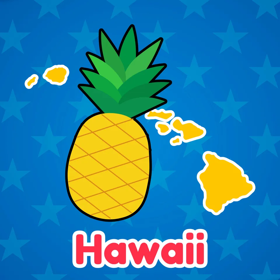
Come learn about the lush paradise of Hawaii
Explore Hawaii's many islands and marvel at its natural beauty, from its stunning beaches to its bright flowers and tasty fruits.
No prior knowledge needed.
Part of
Standards alignment
Common Core State Standards
- D2.Geo.3.K-2 — Individually and with others, students… Use maps, globes, and other simple geographic models to identify cultural and environmental characteristics of places.
- D2.Geo.6.K-2 — Individually and with others, students… Identify some cultural and environmental characteristics of specific places.
- There are many different kinds of living things in any area, and they exist in different places on land and in water.
- D2.Geo.3.3-5 — Individually and with others, students… Use maps of different scales to describe the locations of cultural and environmental characteristics.
Alabama
- SS10.2.6 — Identify states, continents, oceans, and the equator using maps, globes, and technology.
- SS10.5.13.2 — Locating on a map states, capitals, and important geographic features west of the Mississippi River
- SS10.5.13.3 — Explaining how the United States acquired Alaska and Hawaii
Alaska
- 1 — know that places have distinctive geographic characteristics;
- 1 — use maps and globes to locate places and regions;
- 2 — analyze how places are formed, identified, named, and characterized;
- 3 — recognize the concepts used in studying environments and recognize the diversity and productivity of different regional environments.
Arizona
- 2.G1.1 — Use and construct maps, graphs, and other geographic representations of familiar and unfamiliar places in the world; and locate physical and human features. • Key physical features include but are not limited to seven continents, oceans, lakes, rivers, mountain ranges, coasts, seas, and deserts • Key human features include but are not limited to equator, hemispheres, North and South Pole, cities, states, countries, regions, and landmarks
- 2.G1.2 — Use maps, globes, and other simple geographic models to identify and explain cultural and environmental characteristics of places in the world based on stories shared. Arizona History and Social Science Standards modified 8/23/19 Page 19
- 2.G2.1 — Explain how weather, climate, and other environmental characteristics affect people’s lives in a place or region being studied.
- 2.G4.1 — Identify different physical and cultural regions in the world.
Arkansas
- G.1.3.5 — Investigate the cultural characteristics of various places and regions from around the world.
- G.1.1.2 — Describe the physical and human characteristics of a place including roads, buildings, and borders using maps, globes, and photographs.
- G.1.2.10 — Examine how the products that are consumed and the traditions that are celebrated connect people to different parts of the world (e.g., raw materials, art, food, culture).
- G.1.K.2 — Identify and describe the physical characteristics of a place such as rivers, mountains, and forests using maps, globes, and photographs.
California
- 1.2.4 — Describe how location, weather, and physical environment affect the way people live, including the effects on their food, clothing, shelter, transportation, and recreation.
- 2 — Students identify the human and physical characteristics of the places they are studying and explain how those features form the unique character of those places.
- 1.2.1 — Locate on maps and globes their local community, California, the United States, the seven continents, and the four oceans.
- 1.5.3 — Compare the beliefs, customs, ceremonies, traditions, and social practices of the varied cultures, drawing from folklore.
Colorado
- SC.K.3.2 — Plants and animals meet their needs in their habitats and impact one another; people can prepare for severe weather.
- SS.5.2.1 — Use geographic tools and sources to research and answer questions about United States geography.
Connecticut
- GEO 2.6 — Identify cultural and environmental characteristics of a place/region.
- GEO 2.3 — Use geographic representations to identify cultural and environmental characteristics of place.
- GEO 3.2 — Use maps, satellite images, photographs, and other representations to explain relationships between the locations of places and regions and their environmental characteristics.
- There are many different kinds of living things in any area, and they exist in different places on land and in water.
Delaware
- G.1.K-3a — Students will understand the nature and uses of maps, globes, and other geo-graphics. Grade K and Grade 3
- G.2.K-3a — Students will distinguish different types of climate and landforms and explain why they occur. Grade 2
- K-3a — Students will use the concepts of place and region to explain simple patterns of connections between and among places across the country and the world. Grade 3
- There are many different kinds of living things in any area, and they exist in different places on land and in water.
- G.1.4-5a — Students will demonstrate development of mental maps of Delaware and of the United States which include the relative location and characteristics of major physical features, political divisions, and human settlements. Grade 4
Florida
- SS.3.G.3.1 — Describe the climate and vegetation in the United States, Canada, Mexico, and the Caribbean.
- SS.3.G.2.4 — Describe the physical features of the United States, Canada, Mexico, and the Caribbean.
- SS.3.G.2.5 — Identify natural and man-made landmarks in the United States, Canada, Mexico, and the Caribbean.
- SS.5.G.1.6 — Locate and identify states, capitals, and United States Territories on a map.
Georgia
- S3L1.b — Construct an explanation of how external features and adaptations (camouflage, hibernation, migration, mimicry) of animals allow them to survive in their habitat.
- S3L1.c — Use evidence to construct an explanation of why some organisms can thrive in one habitat and not in another.
Hawaii
- SS.4.2.13.1 — Identify major geographic characteristics of the Hawaiian archipelago, including its relative location to other major land masses
- SS.2.3.13.4 — Describe major geographic features of places using maps, photos, and other geographic representations
- SS.3.3.13.1 — Analyze how geographical features affect human life in local communities and those around the world
- SS.1.2.14.3 — Investigate cultural and environmental characteristics of your community
Idaho
- 5.SS.2.1.4 — Name and locate the 50 States and their Capitals, and U.S. Territories.
- Climate describes a range of an area's typical weather conditions and the extent to which those conditions vary over years. (3-ESS-1.2)
- 3.SS.2.1.3 — Locate on a map waterways, landforms, cities, states, and national boundaries, using standard map symbols.
Illinois
- SS.2.G.1 — With guidance and support, use print and digital maps, globes and other simple geographic models to identify cultural and environmental characteristics of places.
- SS.2.G.2 — With guidance and support, identify some cultural and environmental characteristics of your community and compare to other places or regions.
- SS.3.G.1 — Use print and digital maps, globes, and other simple geographic models to identify topographic and other graphic representations of both familiar and unfamiliar locations.
- LS4.D-P1 — There are many different kinds of living things in any area, and they exist in different places on land and in water.
Indiana
- 1.LS.3 — Make observations of plants and animals to compare the diversity of life in different habitats.
- 5.G.2 — Use maps and globes to locate states, capitals, major cities, major rivers, the Great Lakes, and mountain ranges in the United States. (E)
- K.LS.2 — Describe and compare the physical features of common living plants and animals.
Iowa
- SS.K.14. — Compare environmental characteristics in Iowa with other places.
- There are many different kinds of living things in any area, and they exist in different places on land and in water.
- K-ESS3-1 — Use a model to represent the relationship between the needs of different plants and animals (including humans) and the places they live.
Kansas
- 3-ESS2-2 — Obtain and combine information to describe climates in different regions of the world.
- There are many different kinds of living things in any area, and they exist in different places on land and in water.
- Maps show where things are located. One can map the shapes and kinds of land and water in any area.
Kentucky
- 2.G.GR.1 — Examine geographic features of places in North America, using a variety of geographic data, including maps, photos and other geographic tools.
- Climate describes a range of an area's typical weather conditions and the extent to which those conditions vary over years.
- K.G.HE.1 — Identify ways humans interact with their environment.
- Maps show where things are located. One can map the shapes and kinds of land and water in any area.
Louisiana
- 1.11 — Identify Louisiana as a unique state among fifty, and as a part of the United States.
- 2.21 — Describe geographic features and physical characteristics of places in the United States and the world, including mountains, hills, plains, deserts, coasts, islands, peninsulas, lakes, oceans, and rivers.
- 3.20 — Describe the geographic features of places in the United States.
- 2.23 — Describe the relative location of the United States.
Maine
- 3-ESS2-2 — Obtain and combine information to describe climates in different regions of the world.
- 2-LS4-1 — Make observations of plants and animals to compare the diversity of life in different habitats.
- F2 — Identifying the major regions of the Earth and their major physical features and political boundaries using a variety of geographic tools including digital tools and resources. *
Maryland
- DCI.LS4.D.K-2.1 — There are many different kinds of living things in any area, and they exist in different places on land and in water.
- identifying continents and oceans near and far from Maryland on maps and globe.
Massachusetts
- 4.T4e.1 — On a political map of the United States, locate the states in the West and the U.S. territories in the Pacific Ocean; add to the timeline the admission dates for states in the Southwest (states listed alphabetically, Alaska-1959, California-1850, Colorado-1876, Hawaii-1959, Idaho-1890, Montana-1889, Nevada-1864, Oregon-1859, Utah-1896, Washington-1889, Wyoming-1890); territories: American Samoa, Guam, Midway Islands, Northern Mariana Islands, and Wake Island.
- 4.T4e.3 — Describe the diverse cultural nature of the region, including contributions of Native Peoples (e.g., Paiute, Coast Salish) African Americans, Europeans (e.g. the Spanish in California), the Mexicans, the Chinese, Japanese, and immigrant groups from other regions of the world over time.
Michigan
- 4–G1.0.3 — Use geographic tools and technologies, stories, songs, and pictures to answer geographic questions about the United States.
- 4–G2.0.2 — Locate and describe human and physical characteristics of major U.S. regions and compare them to the Great Lakes region.
- 4–G1.0.4 — Use maps to describe elevation, climate, and patterns of population density in the United States.
Minnesota
- 3.3.1.1.1 — Use maps and concepts of location (relative location words and cardinal and intermediate directions) to describe places in one’s community, the state of Minnesota, the United States or the world. For example: Relative location words— close to, above, bordering. Description using relative location words—"Our school is across from the post office." Description using cardinal directions— "Mexico is south of the United States." Description using intermediate directions—“Hawaii is southwest of the continental United States.”
- 4.3.2.3.1 — Locate and identify the physical and human characteristics of places in the United States, and also Canada or Mexico. For example: Physical characteristics—landforms (Rocky Mountains), ecosystems (forest), bodies of water (Mississippi River, Hudson Bay), soil, vegetation, weather and climate. Human characteristics— structures (Statue of Liberty), bridges (Golden Gate Bridge), canals (Erie Canal), cities, political boundaries, population distribution, settlement patterns, language, ethnicity, nationality, religious beliefs.
- 4.3.2.4.1 — Name and locate states and territories, major cities and state capitals in the United States.
- 2.3.1.1.3 — Use maps, photos or other geographic tools to identify and locate major landmarks or major physical features of the United States. For example: Physical features—the Atlantic Coast, Rocky Mountains, Mississippi River, Lake Superior. Landmarks—Statue of Liberty, Angel Island, Gateway Arch in St. Louis, Mount Rushmore, Crazy Horse Memorial.
- 2.3.1.1.4 — Use maps, photos, or other geographic tools to answer basic questions about where people are located. For example: Where are we? What is this location like? What are the characteristics of this location? How has this place been affected by the movement of people, goods and ideas? How do people modify the environment to fit their needs? How do people organize locations into regions? How is this place similar to or different from other places?
Mississippi
- 5.10.2 — Identify and label each of the 50 states on a map.
- K.H.1.2 — Identify school, community, state, and national symbols.
Missouri
- 4.EG.5.B.a — Name and locate specific regions, states, capitals, river systems and mountain ranges in the United States based on historical or current topics.
- 4.EG.5.C.a — Identify and compare physical characteristics of specific regions within the nation.
- 4.EG.5.C.b — Identify and compare diverse human geographic characteristics of the nation.
- 5.EG.5.B.b — Locate and describe real places, using absolute and relative location.
Montana
- SS.G.3.3 — identify landforms and other physical characteristics of the Americas.
- SS.G.5.1 — identify and label US regions, territories, states and their capitals/major cities;
- SS.G.K — The geography content standard for kindergarten is that each student will use maps, and other representations, to describe place characteristics.
- K-ESS3-1 — use a model to represent the relationship between the needs of different plants or animals, including humans, and the places they live;
Nebraska
- SS 5.3.1.a — Use maps and atlases to locate major human and physical features in the United States.
- SS 1.3.2 — Explore places and regions.
- SS 3.3.1.d — Locate specific places on maps and globes.
- SS 5.3.2.b — Identify and classify regions and places within the United States using physical and human features.
Nevada
- There are many different kinds of living things in any area, and they exist in different places on land and in water.
- 2-LS4-1 — Make observations of plants and animals to compare the diversity of life in different habitats.
New Hampshire
- SS.GE.2.1.3 — Identify major physical and human features in the United States and on Earth, e.g., cities, oceans, or continents. (Themes: C: People, Places and Environment, G: Science, Technology, and Society)
- SS.GE.6.1.2 — Apply the spatial concepts of location, distance, direction, scale, movement, and region, e.g., the relative and absolute location of the student's community, or the diffusion of the English language to the United States. (Themes: C: People, Places and Environment, F: Global Transformation)
- SS.GE.6.2.2 — Describe how places and regions preserve culture, e.g., songs or traditions. (Themes: E: Cultural Development, Interaction, and Change, J: Human Expression and Communication)
- SS.GE.6.5.3 — Appreciate how characteristics of different physical environments provide opportunities human activities or place constraints on human activities, e.g., winter sports tourism or annual flood patterns. (Themes: C: People, Places and Environment)
- SS.GE.2.3.2 — Explore the components and distribution of ecosystems, e.g., desert or rain forest. (Themes: C: People, Places and Environment)
New Jersey
- 6.1.5.GeoSV.2 — Use maps to explain the impact of location and place on the relationships between places in New Jersey, the United States and other countries.
- 6.1.5.GeoSV.4 — Use a variety of geographic representations to describe the similarities and differences between places in New Jersey, the United States and the world (e.g., maps, data visualizations, graphs, diagrams, aerial and other photographs, GPS).
- 6.1.5.CivicsPI.5 — Explain how government functions at the local, county, and state level.
New Mexico
- 1.18 — Use a variety of maps to locate specific places and identify major landforms, bodies of water, and other places of significance around the United States.
- 5.27 — Using a map, identify and locate the 50 states in the United States and know the capitals of each state along with the surrounding U.S. territories.
- K.10 — Identify the local, state, and national symbols (e.g., flag, bird, song).
New York
- E.3.1 — Geography can be divided into six essential elements which can be used to analyze important historic, geographic, economic, and environmental questions and issues. These six elements include: the world in spatial terms, places and regions, physical settings (including natural resources), human systems, environment and society, and the use of geography. (Adapted from The National Geography Standards, 1994: Geography for Life)
- There are many different kinds of living things in any area, and they exist in different places on land and in water.
- 1.5b — Maps are used to locate important places in the community, state, and nation, such as capitals, monuments, hospitals, museums, schools, and cultural centers. * According to the Dignity for All Students Act, “others” includes, but is not limited to, people of different races, weights, national origins, ethnic groups, religions, religious practices, mental or physical abilities, sexual orientations, gender identity, and sexes.
- K.6c — Places, physical features, and man-made structures can be located on a map or globe and described using specific geographic vocabulary.
- KL4 — Explore and use new vocabulary and multiple-meaning words and phrases in authentic experiences, including, but not limited to the following:
North Carolina
- K.G.1.1 — Use maps, globes, and/or digital representations to locate places in the classroom, school, community, and around the world.
North Dakota
- 5.R.1 — Comprehend information during and after listening to a grade-level text.
- 5.C.6 — Engage in a range of discussions using active listening skills, posing and responding to specific questions to clarify information.
Ohio
- 1.4 — Maps can be used to locate and identifyplaces.
- 1.5 — Places are distinctive because of their physical characteristics (land forms and bodies of water) and human characteristics (structures built by people).
- 1.LS.2 — Living things survive only in environments that meet their needs.
- 2.8 — Cultures develop in unique ways, in part through the influence of the physical environment.
- K.3 — Heritage is reflected through diverse cultures and is shown through the arts, customs, traditions, family celebrations and language.
Oklahoma
- 4.2.2 — Identify major physical features in the United States and analyze how physical processes shape places. A. Identify and describe the physical characteristics of places, including the major landforms, bodies of water, vegetation and climates in the United States. B. Describe the location and characteristics of the major ecosystems in the United States.
- 4.3.2 — Examine the characteristics of culture, including the distribution and complexity of the regions of the United States. A. Identify the characteristics of culture (language, customs, beliefs, food, clothing, shelter) and compare the cultural characteristics of different regions of the United States. B. Explain how the characteristics of culture affect the ways in which people live.
- 4.2.4 — Describe how physical processes of the Earth’s surface impact humans and their environment. A. Identify and describe the different climates in the United States using maps, globes, and graphs. B. Explain how climate and natural processes including floods, wind, and storms impact how we live.
- 4.2.5 — Identify and locate on a political map the fifty states and the United States capitol.
Oregon
- 2.14 — Use and apply cardinal directions to locate and identify features on maps (such as oceans, cities, continents).
Pennsylvania
- 7.1.3.B — Identify and locate places and regions.
- 7.2.3.A — Identify the physical characteristics of places and regions.
- 7.3.3.E — Identify the human characteristics of places and regions by their political activities.
- 7.3.6.B — Describe the human characteristics of places and regions by their cultural characteristics.
Rhode Island
- SS3.6.1 — Geography and environment of the West Explain the geography and environment of the Western region of the United States
- SS3.6.2 — States and territories in the West Explain the states and territories that make up the Western region including their admittance or incorporation to the United States and their identities
- SS3.1.3 — States and territories Explain what states and territories are and their locations within the United States
- SS3.6.4 — The Western region today Argue how the geography and environment of the Western region contributed to its social, cultural, and economic development
- Climate describes a range of an area's typical weather conditions and the extent to which those conditions vary over years.
South Carolina
- 2-LS4-1.DCI.D: — Biodiversity and Humans There are many different kinds of living things in any area, and they exist in different places on land and in water. NRC Framework Link
- 2.G.2 — Describe and compare various landforms over time within the U.S. through the use of primary and secondary sources. This indicator was developed to encourage inquiry into using historic images, maps, narratives, texts, or video, to investigate and compare different landforms around the U.S.
- 3.1.3.PR — Identify the spatial hierarchy of political and physical geographic features. This indicator prompts students to inquire about spatial hierarchies (i.e. scale) to understand connections between Earth's systems. Political features include cities, states, and countries. Physical features include forests, mountains, oceans, and rivers.
- K.G.2 — Utilize sources of geographic information (e.g., digital sources, maps, or photographs/images) to define and identify cultural and/or natural features.This indicator was developed to encourage inquiry into natural features, such as mountains, oceans, and rivers and cultural features, such as buildings, restaurants, roads, and stores.
South Dakota
- 1.G.1.3 — Distinguish between landmasses and bodies of water using maps and globes
- 3.G.1.2 — Locate the seven continents, four oceans, and major physical features and regions of the United States on a map or globe
- 2-LS4-1 — Make observations of plants and animals to compare the diversity of life in different habitats.
- K.G.1.1 — Recognize that maps and globes represent places
Tennessee
- 3.09 — Identify and locate the fifty states of the U.S.
- 2.16 — Compare physical features of the earth, including: • Island • Ocean • Plateau • Lake • Peninsula • River • Mountain • Plain • Valley
- 2.18 — Analyze how the location of regions affects the way people live, including their: food, clothing, shelter, transportation, and recreation.
- 1.01 — Describe the cultural aspects of a place, including a student’s community and state.
Texas
- 2.11D — identify symbols such as state and national birds and flowers and Uncle Sam; and
- 1.5A — identify and describe the physical characteristics of place such as landforms, bodies of water, Earth's resources, and weather; and
- 5.6C — locate on a map important political features such as the five largest cities by population in the United States and the 50 states; and
- K.4B — identify how geographic location influences human characteristics of place such as shelter, clothing, food, and activities.
- 2.1B — identify and explain the significance of various community, state, and national landmarks such as monuments and government buildings.
Utah
- 1.3.2.b — Locate physical features (i.e. continents, oceans, rivers, lakes), and man-made features (equator, North and South poles, countries) on a map and on a globe.
- 2.2.1 — Obtain, evaluate, and communicate information about patterns of living things (plants and animals, including humans) in different habitats. Emphasize the diversity of living things in land and water habitats. Examples of *patterns*in habitats could include descriptions of temperature or precipitation and the types of plants and animals found in land habitats. (LS2.C, LS4.C, LS4.D)
- 2.3 — Standard 3: Students will use geographic tools and skills to locate and describe places on earth.
Vermont
- D2.Geo.6.K-2 — Individually and with others, students… Identify some cultural and environmental characteristics of specific places.
- D2.Geo.11.K-2 — Individually and with others, students… Explain how the consumption of products connects people to distant places.
- D2.Geo.2.K-2 — Individually and with others, students… Use maps, graphs, photographs, and other representations to describe places and the relationships and interactions that shape them.
- D2.Geo.3.K-2 — Individually and with others, students… Use maps, globes, and other simple geographic models to identify cultural and environmental characteristics of places.
- There are many different kinds of living things in any area, and they exist in different places on land and in water.
Virginia
- Skill.2.b — The student will apply history and social science skills to the content by applying geographic skills to identify and understand geographic features and connections.
- USI.1.c — The student will apply history and social science skills to understand the geography of North America by locating the 50 states.
- 2.11.b — The student will apply history and social science skills to develop geographic mapping skills using world maps and globes by identifying major rivers, mountain ranges, lakes, and other physical features in the United States.
Washington
- G1.3.2 — Investigate the physical, political, and cultural characteristics of places, regions, and people in North America, including the location of the fifty states within the regions of the United States.
- G2.2.1 — Identify some common and unique cultural and environmental characteristics of specific places.
- G1.2.2 — Use maps, globes, and other simple geographic models to identify cultural and environmental characteristics of places.
- G1.3.1 — Examine and use maps and globes to understand the regions of North America in the past and present.
- G1.2.3 — Use maps, graphs, photographs and other representations to describe places and the relationships and interactions that shape them.
Washington, D.C.
- 1.19 — Locate and explain physical features on maps.
- K.20 — Explain the concept of relative location using directional words.
- K-ESS3-1 — Use a model to represent the relationship between the needs of different plants and animals (including humans) and the places they live.
West Virginia
- SS.3.13 — Distinguish between a continent, country, state and capital.
- SS.4.8 — Describe and locate examples of the major physical features ofthe United States (e.g., bodies of water, mountains, rivers, grasslands, oases, etc.) using references and technology (e.g., atlas, globe, geographic information system, etc.).
- SS.5.17 — Compare and contrast the various regions of the United States; locate each of the fifty United States and correlate them with their regions.
- S.3.14 — Obtain and combine information to describe climates in different regions of the world.
Wisconsin
- Maps show where things are located. One can map the shapes and kinds of land and water in any area.
- There are many different kinds of living things in any area, and they exist in different places on land and in water.
- SS.Geog4.a.4 — Describe how certain places may have meanings that distinguish them from other places (e.g., cemetery, places of worship, state or national parks, historical park, or battlefield). Compare and contrast the human characteristics of rural, suburban, urban, and tribal locations in Wisconsin and the United States. Identify and describe how people may view places in the community differently (e.g., students and senior citizens responding to a new playground).
- SS.PS1.a.K-1 — Describe symbols, songs, and traditions that identify our state and country. Assess the importance of rules and laws at home, in school, and in the community.
- SS.Geog5.b.2 — Identify natural resources (e.g., fertile soil, forests, mining) of a place and provide examples of how those resources are used.
Wyoming
- SS5.2.2 — Describe, compare and contrast ways in which unique expressions of culture (e.g., tribal affiliation, language, spirituality, stories, folktales, music, art, and dance) influence people. RL.3.2, RL.4.7, RL.4.9 RI.3.3, RI.4.3, RI.5.3 W.3.2, W.3.7, W.4.2.b W.5.2.b, W.5.7 SL.3.4 4-ESS1-1 FPA4.3.D.1-D4, 4.D.5 FPA8.1.A.1, 8.3.A.1-2 FPA8.2.D.1 – D.2 FPA8.2.T.3, 3.T.1, 4.T.5 FPA8.3.M.1 – M.3 FPA8.4.A.2 CV5.2.3
- SS5.5.1 — Spatial Apply mental mapping skills and use different representations of the Earth to demonstrate an understanding of human and physical patterns and how local decisions may create global impacts.
- SS5.5.2 — Physical Place and Region Explain how physical features, patterns, and systems impact different regions and how these features may help us generalize and compare areas within the reservation, state, nation, or world. RL.3.2, RL.4.7, RL.4.9 RI.3.3, RI.4.3, RI.5.3 W.3.2, W.3.7, W.4.2.b W.5.2.b W.5.7 SL.3.4
- 2-LS4-1 — Make observations of plants and animals to compare the diversity of life in different habitats.
- SS5.5.3 — Human Place and Movement Describe the human features of an area (e.g., language, religion, political and economic systems, population distribution, and quality of life), past and present settlement patterns (e.g., Indigenous Tribes of Wyoming and the Oregon Trail), and how ideas, goods, and/or people move from one area to another. Benchmark_Component Sub-Item :SS5.5.3.a.i Human Place and Movement Describe how cultural values of the Indigenous Tribes of Wyoming influence the importance and preservation of place and sacred sites (e.g., Devils Tower/Bear Lodge, Hot Springs State Park, Vedauwoo, Crowheart Butte, Bighorn Medicine Wheel, Estes Park, Yellowstone, Heart Mountain, and Wind River Mountains). Benchmark_Component Sub-Item :SS5.5.3.a.ii Human Place and Movement Describe and identify a variety of place names and their connection to Indigenous Tribes of Wyoming. RL.3.2, RL.4.7, RL.4.9 RI.3.3, RI.4.3, RI.5.3 W.3.2, 3.7, 4.2.b, W.5.2.b, 5.7 SL.3.4