Africa
Ages 4–6 · 13 minutes · Geography
Explore some of the famous landforms in Africa, including Mount Kilimanjaro and Victoria Falls
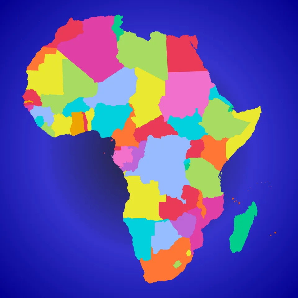
In this lesson, students will about the continent of Africa. They will explore famous landforms, including the Sahara Desert, the Nile River, Mount Kilimanjaro and Victoria Falls.
Part of
Standards alignment
Common Core State Standards
- D2.Geo.2.K-2 — Individually and with others, students… Use maps, graphs, photographs, and other representations to describe places and the relationships and interactions that shape them.
- D2.Geo.4.K-2 — Individually and with others, students… Explain how weather, climate, and other environmental characteristics affect people’s lives in a place or region.
- D2.Geo.6.K-2 — Individually and with others, students… Identify some cultural and environmental characteristics of specific places.
- D2.Geo.7.K-2 — Individually and with others, students… Explain why and how people, goods, and ideas move from place to place.
- D2.Geo.8.K-2 — Individually and with others, students… Compare how people in different types of communities use local and distant environments to meet their daily needs.
Alabama
- SS10.1.8.3 — Using vocabulary associated with geographical features, including _river, lake, ocean,_ and _mountain_
- SS10.K.9 — Differentiate between land forms and bodies of water on maps and globes.
- SS10.1.8 — Identify land masses, bodies of water, and other physical features on maps and globes.
- SS10.2.6 — Identify states, continents, oceans, and the equator using maps, globes, and technology.
Alaska
- 1 — know that places have distinctive geographic characteristics;
- 3 — recognize the concepts used in studying environments and recognize the diversity and productivity of different regional environments.
- 7 — understand that a region is a distinct area defined by one or more cultural or physical features; and
- 1 — use maps and globes to locate places and regions;
- 2 — explain how and why human networks, including networks for communications and for transportation of people and goods, are linked globally;
Arizona
- 1.G1.1 — Use, explore and construct maps, graphs and other geographical representations to support content focus. • Key concepts include but are not limited to physical features (rivers, lakes, mountains, landforms, desert) and human features (dams, cities, parks, hospitals, schools, railroad tracks, farms, factories, houses)
- 1.G3.1 — Explain why and how people, goods, and ideas move from place to place. • Key concepts include but are not limited to transportation, immigration, education, technology, and natural resources
- 2.G1.1 — Use and construct maps, graphs, and other geographic representations of familiar and unfamiliar places in the world; and locate physical and human features. • Key physical features include but are not limited to seven continents, oceans, lakes, rivers, mountain ranges, coasts, seas, and deserts • Key human features include but are not limited to equator, hemispheres, North and South Pole, cities, states, countries, regions, and landmarks
- K.G2.1 — Explain how water and weather impacts humans.
- 1.E1U1.5 — Obtain, evaluate, and communicate information about the properties of Earth materials and investigate how humans use natural resources in everyday life.
Arkansas
- G.1.K.2 — Identify and describe the physical characteristics of a place such as rivers, mountains, and forests using maps, globes, and photographs.
- G.1.K.6 — Identify the influence of weather and climate on people’s daily lives.
- G.1.1.8 — Discuss reasons and methods people, goods, and ideas move from place to place.
- G.1.K.8 — Identify people, goods, and ideas that move from place to place.
- G.1.1.2 — Describe the physical and human characteristics of a place including roads, buildings, and borders using maps, globes, and photographs.
California
- 1.2.1 — Locate on maps and globes their local community, California, the United States, the seven continents, and the four oceans.
- 1.2.4 — Describe how location, weather, and physical environment affect the way people live, including the effects on their food, clothing, shelter, transportation, and recreation.
- 2 — Students identify the human and physical characteristics of the places they are studying and explain how those features form the unique character of those places.
- K.4.2 — Distinguish between land and water on maps and globes and locate general areas referenced in historical legends and stories.
- SL.K.4 — Describe familiar people, places, things, and events and, with prompting and support, provide additional detail.
Colorado
- SS.K.2.1 — Recognize that geographic tools represent places and spaces.
- SS.K.2.2 — Identify how the environment influences the way people live.
- SS.P.2.1 — Develop spatial understanding, perspectives, and connections to the world
- PGS.4 — Examine the characteristics of places and regions, and the changing nature among geographic and human interactions.
- SS.1.2.1 — Use geographic terms and tools to describe places and spaces.
Connecticut
- GEO.K.2 — Use maps, graphs, photographs and other representations to describe places and the relationships and interactions that shape them.
- GEO.K.3 — Use maps, globes, and other simple geographic models to identify cultural and environmental characteristics of places.
- GEO.K.4 — Explain how weather, climate, and other environmental characteristics affect people’s lives in places or regions.
- Living things need water, air, and resources from the land, and they live in places that have the things they need. Humans use natural resources for everything they do.
Delaware
- G.2.K-3a — Students will distinguish different types of climate and landforms and explain why they occur. Grade 2
- Living things need water, air, and resources from the land, and they live in places that have the things they need. Humans use natural resources for everything they do.
- K-3a — Students will use the concepts of place and region to explain simple patterns of connections between and among places across the country and the world. Grade 3
- Water is found in the ocean, rivers, lakes, and ponds. Water exists as solid ice and in liquid form.
- G.1.K-3a — Students will understand the nature and uses of maps, globes, and other geo-graphics. Grade K and Grade 3
Florida
- SS.K.G.3.1 — Identify basic landforms.
- SS.K.G.1.4 — Differentiate land and water features on simple maps and globes.
- SS.K.G.3.2 — Identify basic bodies of water.
- SS.K.G.3.3 — Describe and give examples of seasonal weather changes, and illustrate how weather affects people and the environment.
- SS.2.G.1.3 — Label on a map or globe the continents, oceans, Equator, Prime Meridian, North and South Pole.
Georgia
- SS1G3.a — Locate all of the continents: North America, South America, Africa, Europe, Asia, Antarctica, and Australia.
- SS1G3.c — Identify and describe landforms (mountains, deserts, valleys, and coasts).
- ELAGSEKSL4 — Describe familiar people, places, things, and events and, with prompting and support, provide additional detail.
- SSKG2.a — Differentiate land and water features on simple maps and globes.
Hawaii
- SS.1.2.13.2 — Describe some physical features of continents and oceans in the world
- SS.K.3.15.4 — Describe how and why people move from place to place
- SS.K-2.2.3 — Gather facts from teacher and/or adult-curated sources to answer questions
Idaho
- 1.SS.2.1.4 — Identify continents and large bodies of water on a globe or a map.
- 1.SS.2.2.1 — Describe ways people adjust to their environment.
- 2.SS.2.1.1 — Identify landforms, bodies of water, and human made features such as cities and dams on a map and globe.
- K.SS.2.1.2 — Distinguish between land masses and water on a globe or map.
Illinois
- SS.K.G.2 — With guidance and support, explain how people and goods move from place to place.
- SS.1.G.3 — Compare how people in different types of communities use local and world-wide environments to meet their daily needs.
- SS.K.G.1 — With guidance and support, explain how weather, climate and other environmental factors affect people's lives and cultural identities in our region.
- ESS2.B-P1 — Maps show where things are located. One can map the shapes and kinds of land and water in any area.
- ESS2.C-P1 — Water is found in the ocean, rivers, lakes, and ponds. Water exists as solid ice and in liquid form.
Indiana
- 1.G.2 — Identify and describe continents, hemispheres, oceans, cities, and roads on maps and globes. (E)
- K.G.2 — Identify maps and globes as ways of representing Earth and understand the basic difference between a map and globe, including the difference in water/oceans and land/continents.
Iowa
- Evaluate Human Environment Interaction
- SS.K.14. — Compare environmental characteristics in Iowa with other places.
- SS.K.15. — Explain why and how people move from place to place.
- Maps show where things are located. One can map the shapes and kinds of land and water in any area.
Kansas
- Living things need water, air, and resources from the land, and they live in places that have the things they need. Humans use natural resources for everything they do.
- There are many different kinds of living things in any area, and they exist in different places on land and in water.
- Water is found in the ocean, rivers, lakes, and ponds. Water exists as solid ice and in liquid form.
- Maps show where things are located. One can map the shapes and kinds of land and water in any area.
- Use observations (firsthand or from media) to describe patterns and/or relationships in the natural and designed world(s) in order to answer scientific questions and solve problems.
Kentucky
- K.G.HE.1 — Identify ways humans interact with their environment.
- K.G.KGE.1 — Identify physical and environmental characteristics of communities.
- K.G.MM.1 — Identify why and how people and goods move to and within communities.
- Living things need water, air, and resources from the land, and they live in places that have the things they need. Humans use natural resources for everything they do.
Louisiana
- K.19 — Identify basic landforms and bodies of water in a variety of visual representations, including mountains, hills, coasts, islands, lakes, and rivers.
- K.22 — Explain how weather impacts daily life and choices.
- 1.31 — Explain how and why people and goods move from place to place.
- 2.21 — Describe geographic features and physical characteristics of places in the United States and the world, including mountains, hills, plains, deserts, coasts, islands, peninsulas, lakes, oceans, and rivers.
Maine
- Read grade-appropriate texts and/or use media to obtain scientific and/or technical information to determine patterns in and/or evidence about the natural and designed world(s).
- 2-ESS2-2 — Develop a model to represent the shapes and kinds of land and bodies of water in an area.
- 2-ESS2-3 — Obtain information to identify where water is found on Earth and that it can be solid or liquid.
- SL.3.K.a — Describe familiar people, places, things, and events and, with prompting and support, provide additional detail.
Maryland
- identifying continents and oceans near and far from Maryland on maps and on a globe.
- explaining how transportation links goods and people both near and far.
- identifying continents and oceans near and far from Maryland on maps and globe.
- DCI.ESS3.A.K-2.1 — Living things need water, air, and resources from the land, and they live in places that have the things they need. Humans use natural resources for everything they do.
- DCI.ESS2.B.K-2.1 — Maps show where things are located. One can map the shapes and kinds of land and water in any area.
- DCI.LS4.D.K-2.1 — There are many different kinds of living things in any area, and they exist in different places on land and in water.
Massachusetts
- 1.T2.4 — Locate and explain physical features (e.g., continents, oceans, rivers, lakes, mountains) on maps and construct maps and other representations of local places.
- 2.T2.4 — Explain and describe human interaction with the physical world (the environment).
Michigan
- 1–G1.0.3 — Distinguish between landmasses and bodies of water using maps and globes.
- 1–G5.0.2 — Describe ways in which the physical environment in a place or region affects people’s lives.
- 1–G2.0.1 — Distinguish between physical and human characteristics of places.
- 1–G5.0.1 — Describe ways in which people are part of, modify, and adapt to their physical environments.
Minnesota
- 0.3.2.3.1 — Identify the physical and human characteristics of places, including real and imagined places. For example: Physical characteristics—landforms (Rocky Mountains, Mount Everest), ecosystems (forest), bodies of water (Hudson Bay, Indian Ocean, Amazon River), soil, vegetation, weather and climate. Human characteristics—structures (Great Wall of China, Eiffel Tower), bridges (Golden Gate Bridge), canals (Erie Canal), cities, political boundaries, population distribution, settlement patterns, language, ethnicity, nationality, religious beliefs.
- 3. — Places have physical characteristics (such as climate, topography and vegetation) and human characteristics (such as culture, population, political and economic systems).
- 0L.1.2.1.2 — Make observations of plants and animals to compare the diversity of life in different habitats. (P: 3, CC: 1, CI: LS4)
Mississippi
- 1.G.1.1 — Identify the seven continents and five major oceans.
- K.G.2.2 — Define physical features and analyze how physical features of the Earth impact the way of life in various places.
- 1.G.1.2 — Classify the major landforms, and bodies of water on a map (e.g., mountains, hills, lakes, oceans, rivers, etc.).
- 1.G.2.3 — Describe how location impacts daily life for residents in various communities (e.g., shelter, clothing, food, activities, etc.).
- K.G.2.1 — Differentiate landforms from bodies of water.
Missouri
- 2.EG.5.C.a — Identify and describe physical characteristics of the world.
- 2.EG.5.B.b — Name and locate regions of the world.
- 2.EG.5.G.a — Explain how geography affects the way people live today.
- 2.EG.5.E.a — Describe different types of communication and transportation and identify their advantages and disadvantages.
Montana
- SL.K.4 — Describe familiar people, places, things, and events and, with prompting and support, provide additional detail.
- SS.G.K — The geography content standard for kindergarten is that each student will use maps, and other representations, to describe place characteristics.
- SS.G.1.1 — identify and describe human and physical local landmarks; and
Nebraska
- SS 1.3.1.d — Distinguish between continents and oceans.
- SS K.3.2.a — Identify physical characteristics of place.
- SS 1.3.2.a — Identify and differentiate between physical features on maps, globes, graphics, and in the physical world.
- SS K.3.2 — Explore places and regions.
- SS K.3.3.a — Identify types of weather and the impact of weather on everyday life.
Nevada
- Living things need water, air, and resources from the land, and they live in places that have the things they need. Humans use natural resources for everything they do.
- Maps show where things are located. One can map the shapes and kinds of land and water in any area.
- Water is found in the ocean, rivers, lakes, and ponds. Water exists as solid ice and in liquid form.
- SS.1.20 — Describe how the environment impacts how we live and the work we do.
- There are many different kinds of living things in any area, and they exist in different places on land and in water.
New Hampshire
- SS.GE.2.1.3 — Identify major physical and human features in the United States and on Earth, e.g., cities, oceans, or continents. (Themes: C: People, Places and Environment, G: Science, Technology, and Society)
- SS.GE.2.2.1 — Explore the physical and human characteristics of place, e.g., roads, schools or mountains. (Themes: C: People, Places and Environment, E: Cultural Development, Interaction, and Change, G: Science, Technology, and Society)
- SS.GE.2.2.2 — Recognize that areas of the Earth's surface share unifying geographic characteristics, e.g., towns, deserts or woodlands. (Themes: C: People, Places and Environment)
- SS.CV.2.3.1 — Explain that the world is divided into different countries. (Themes: A: Conflict and Cooperation, B: Civic Ideals, Practices, and Engagement, E: Cultural Development, Interaction, and Change)
- SS.GE.2.5.2 — Investigate how people use resources, e.g., building homes or the food they eat. (Themes: C: People, Places and Environment, D: Material Wants and Needs)
- SS.GE.2.4.2 — Identify what are natural resources, e.g., water or trees. (Themes: C: People, Places and Environment)
New Jersey
- 6.1.2.Geo.SV.1 — Use maps to identify physical features (e.g., continents, oceans, rivers, lakes, mountains).
- 6.1.2.Geo.GI.1 — Explain why and how people, goods, and ideas move from place to place.
- 6.1.2.Geo.HE.1 — Explain how seasonal weather changes, climate, and other environmental characteristics affect people's lives in a place or region.
- 6.1.2.GeoPP.1 — Explain the different physical and human characteristics that might make a location a good place to live (e.g., landforms, climate and weather, resource availability).
New Mexico
- Water is found in the ocean, rivers, lakes, and ponds. Water exists as solid ice and in liquid form.
- There are many different kinds of living things in any area, and they exist in different places on land and in water.
- Maps show where things are located. One can map the shapes and kinds of land and water in any area.
- Living things need water, air, and resources from the land, and they live in places that have the things they need. Humans use natural resources for everything they do.
New York
- E.3.1 — Geography can be divided into six essential elements which can be used to analyze important historic, geographic, economic, and environmental questions and issues. These six elements include: the world in spatial terms, places and regions, physical settings (including natural resources), human systems, environment and society, and the use of geography. (Adapted from The National Geography Standards, 1994: Geography for Life)
- 1.6a — People and communities depend on the physical environment for natural resources.
- K.7 — People and communities are affected by and adapt to their physical environment.
- K.7a — Climate, seasonal weather changes, and the physical features associated with the community and region all affect how people live.
- K.6c — Places, physical features, and man-made structures can be located on a map or globe and described using specific geographic vocabulary.
North Carolina
- K.G.1.2 — Identify physical features of places using maps, globes, and/or digital representations.
- 1.G.1.1 — Use maps, globes, and/or digital representations to identify various types of landforms of places around the world.
- 1.G.2.1 — Explain the various ways the physical environment impacts people in different regions around the world.
- K.G.2.1 — Explain ways people around the world use natural resources.
- K.G.1 — Apply simple geographic representations, tools, and terms to describe surroundings.
North Dakota
- Maps show where things are located. One can map the shapes and kinds of land and water in any area.
- Water is found in the ocean, rivers, lakes and ponds. Water exists as solid ice and in liquid form.
- K.R.3.a — Tell about the informational text, photographs, or illustrations before, during, or after a shared reading or other text-listening experience.
- There are many kinds of living things in any area, and they exist in different places on land and in water.
Ohio
- 1.5 — Places are distinctive because of their physical characteristics (land forms and bodies of water) and human characteristics (structures built by people).
- K.7 — Humans depend on and impact the physical environment in order to supply food, clothing and shelter.
- 1.6 — Families interact with the physical environment differently in different times and places.
Oklahoma
- 1.2.3 — Identify the difference between continents and oceans.
- 2.2.4 — Identify and locate basic landforms, bodies of water, continents, and oceans on a map.
- K.7.R — Students will explore ideas and topics in multimodal content.
- Water is found in the ocean, rivers, lakes, and ponds. (2.ESS2.3)
Oregon
- 2.ESS2.2 — Develop a model to represent the shapes and kinds of land and bodies of water in an area. [Clarification Statement: Examples of model could include a map identifying components of specific bodies of water (e.g. creek, ocean, lake, river) and shapes of land describing their relationship (e.g. playground, park, hill).][assessment boundary: assessment does not include quantitative scaling in models.]
- K.SL.4 — Describe familiar people, places, things, and events and, with prompting and support, provide additional detail.
- 1.8 — Give examples of local natural resources and describe how people use them.
- K.9 — Identify, compare, and contrast pictures, maps, and globes.
Pennsylvania
- 3.4.K-2.C — Explain ways that places differ in their physical characteristics, their meaning, and their value and/or importance.
- Maps show where things are located. One can map the shapes and kinds of land and water in any area.
- There are many different kinds of living things in any area, and they exist in different places on land and in water.
- 3.5.K-2.BB — Compare the natural world and human-made world.
- 3.4.K-2.A — Categorize ways people harvest, redistribute, and use natural resources.
Rhode Island
- SS2.1.2 — Physical features of the globe Explain global physical and geographical features
- SS2.1.3 — Natural resources around the globe Analyze the use of natural resources around the globe and how resources affect human settlement
- Living things need water, air, and resources from the land, and they live in places that have the things they need. Humans use natural resources for everything they do.
South Carolina
- K.G.2 — Utilize sources of geographic information (e.g., digital sources, maps, or photographs/images) to define and identify cultural and/or natural features.This indicator was developed to encourage inquiry into natural features, such as mountains, oceans, and rivers and cultural features, such as buildings, restaurants, roads, and stores.
- K-ESS3-1.DCI.A: — Natural Resources Living things need water, air, and resources from the land, and they live in places that have the things they need. Humans use natural resources for everything they do. NRC Framework Link
South Dakota
- 1.G.1.3 — Distinguish between landmasses and bodies of water using maps and globes
- K.G.6.1 — Describe ways people rely on the environment to meet human needs and wants
- 1.G.6.1 — Describe ways in which people modify and adapt to the environment
- K.SL.4 — Describe familiar people, places, things, and events. With prompting and support, provide additional detail.
Tennessee
- 1.13 — Distinguish the difference between a lake, mountain, ocean, and river.
- 2.18 — Analyze how the location of regions affects the way people live, including their: food, clothing, shelter, transportation, and recreation.
- SSP.06 — Develop geographic awareness by: • Identifying geographic symbols on maps and globes • Understanding relationships between people, places, and resources
- 2.12 — Identify and locate the four hemispheres (i.e., Northern, Southern, Eastern, and Western), equator, prime meridian, North and South Poles, and the seven continents.
Texas
- K.4A — identify the physical characteristics of place such as landforms, bodies of water, Earth's resources, and weather; and
- K.4B — identify how geographic location influences human characteristics of place such as shelter, clothing, food, and activities.
- 1.5A — identify and describe the physical characteristics of place such as landforms, bodies of water, Earth's resources, and weather; and
- 1.5B — identify and describe how geographic location influences the human characteristics of place such as shelter, clothing, food, and activities.
- 2.4A — identify major landforms and bodies of water, including each of the seven continents and each of the oceans, on maps and globes; and
Utah
- K.3.1.b — Identify and describe physical features (e.g., mountain/hill, lake/ocean, river, road/highway).
- K.3 — Students will use geographic terms and tools.
- K.3.2.b — Distinguish between land and water on maps and globes.
Vermont
- D2.Geo.2.K-2 — Individually and with others, students… Use maps, graphs, photographs, and other representations to describe places and the relationships and interactions that shape them.
- D2.Geo.4.K-2 — Individually and with others, students… Explain how weather, climate, and other environmental characteristics affect people’s lives in a place or region.
- D2.Geo.6.K-2 — Individually and with others, students… Identify some cultural and environmental characteristics of specific places.
- D2.Geo.7.K-2 — Individually and with others, students… Explain why and how people, goods, and ideas move from place to place.
- D2.Geo.8.K-2 — Individually and with others, students… Compare how people in different types of communities use local and distant environments to meet their daily needs.
Virginia
- Skill.K.b — The student will apply history and social science skills to the content by applying geographic skills to identify and understand geographic features.
- 1.6.c — The student will apply history and social science skills to develop geographic skills by locating Virginia, the United States, continents, and oceans on maps and globes.
- Skill.1.b — The student will apply history and social science skills to the content by applying geographic skills to identify and understand geographic features.
- K.4.a — Water has many uses.
Washington
- G1.1.2 — Be able to identify large continental land masses on a map or globe.
- G2.K.1 — Explain how weather, climate, and other environmental characteristics affect people’s lives in a place or region.
- G2.K.2 — Identify natural events or physical features such as air, water, land, or wind.
- G3.1.2 — Identify the common and unique characteristics of different global environments.
- G1.1.3 — Be able to identify major bodies of water on a map or globe.
Washington, D.C.
- 1.23 — Describe how location, weather and physical environment affect the way people live, including the effects on their food, clothing, shelter, transportation and recreation.
- 2.4 — Identify and locate the seven continents and five oceans using maps, and describe major geographic features around the world.
- 1.19 — Locate and explain physical features on maps.
- 1.18 — Compare the features of a city, county, state, country and continent.
West Virginia
- SS.2.10 — Identify the continents and oceans on a map and globe.
Wisconsin
- SS.Geog1.b.1-2 — Identify physical and human characteristics of a place using maps, graphs, photographs, and other representations.
- SS.Geog3.b.2 — Compare and contrast the different modes of transportation and communication used by families in work and daily lives.
- SS.Geog5.b.2 — Identify natural resources (e.g., fertile soil, forests, mining) of a place and provide examples of how those resources are used.
- SS.Econ1.a.1 — Differentiate between a “want” and a “need”. Describe resources that are important or useful to you, your family, community, and country.
Wyoming
- SS2.5.4 — Environment and Society Identify how people, including Indigenous Tribes of Wyoming, may adjust to and/or change their environment in order to survive (e.g., clothing, houses, foods, and natural resources). RL.1.2, RL.2.3 RI.1.3, Rl.2.2, RI.2.10 W.K.2, W.K.7 W.1.1, W.1.7 W.2.1 W.2.7 SL.K.4, SL.1.4 SL.2.2 K-2-ETS1-1, 2-ESS2-1
- Maps show where things are located. One can map the shapes and kinds of land and water in any area.
- SS2.4.2 — Identify tools and technologies, including those of Indigenous Tribes of Wyoming, that made or make life easier and sustainable (e.g., cars for getting one place to another, washing machines for washing clothes, flashlights to see in the dark, and usage of bison and natural resources). 2.MD.7 – 8 K-2-ETS1-1 – ETS1-3
- SS2.5.1 — Spatial Use a map, globe, and mental mapping to identify familiar areas and simple patterns and create maps using various media. 2-ESS2-2