North America
Ages 4–6 · 9 minutes · Geography
Learn about the countries of North America, check out some flags, and discover different foods
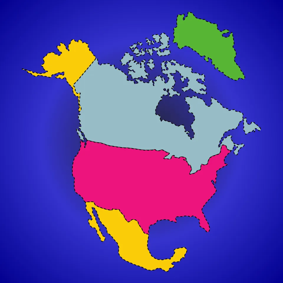
In this lesson, students will learn about the continent of North America, including some North American countries and their flags. And they will learn about some of the agricultural products common in North America.
Part of
Standards alignment
Common Core State Standards
- D2.Geo.2.K-2 — Individually and with others, students… Use maps, graphs, photographs, and other representations to describe places and the relationships and interactions that shape them.
- D2.Geo.3.K-2 — Individually and with others, students… Use maps, globes, and other simple geographic models to identify cultural and environmental characteristics of places.
- D2.Geo.11.K-2 — Individually and with others, students… Explain how the consumption of products connects people to distant places.
- D2.Geo.6.K-2 — Individually and with others, students… Identify some cultural and environmental characteristics of specific places.
Alabama
- SS10.1.8 — Identify land masses, bodies of water, and other physical features on maps and globes.
- SS10.1.8.3 — Using vocabulary associated with geographical features, including _river, lake, ocean,_ and _mountain_
- SS10.K.8 — Recognize maps, globes, and satellite images.
- SS10.2.6 — Identify states, continents, oceans, and the equator using maps, globes, and technology.
Alaska
- 1 — know that places have distinctive geographic characteristics;
- 1 — use maps and globes to locate places and regions;
- 3 — recognize the concepts used in studying environments and recognize the diversity and productivity of different regional environments.
- 7 — understand that a region is a distinct area defined by one or more cultural or physical features; and
Arizona
- K.G1.1 — Use, explore, and construct maps, graphs and other geographical representations to support content focus. • Key concepts include but are not limited to graphing local weather and mapping the classroom.
- 1.G1.1 — Use, explore and construct maps, graphs and other geographical representations to support content focus. • Key concepts include but are not limited to physical features (rivers, lakes, mountains, landforms, desert) and human features (dams, cities, parks, hospitals, schools, railroad tracks, farms, factories, houses)
- 2.G1.1 — Use and construct maps, graphs, and other geographic representations of familiar and unfamiliar places in the world; and locate physical and human features. • Key physical features include but are not limited to seven continents, oceans, lakes, rivers, mountain ranges, coasts, seas, and deserts • Key human features include but are not limited to equator, hemispheres, North and South Pole, cities, states, countries, regions, and landmarks
- 2.E3.1 — Identify and describe the goods and services that are produced around the world.
Arkansas
- E.1.K.10 — Identify where products used in daily life are produced.
- G.1.K.2 — Identify and describe the physical characteristics of a place such as rivers, mountains, and forests using maps, globes, and photographs.
- G.1.K.9 — Discuss products and traditions that connect people around the world (e.g., where products are made, celebrations, dance, art, food, toys).
- K.RC.4.RF — Build general and academic vocabulary and background knowledge of age and grade-appropriate topics through discussion, reading, and writing.
California
- 1.2.1 — Locate on maps and globes their local community, California, the United States, the seven continents, and the four oceans.
- 2 — Students identify the human and physical characteristics of the places they are studying and explain how those features form the unique character of those places.
- K.4.2 — Distinguish between land and water on maps and globes and locate general areas referenced in historical legends and stories.
- 2.2.2 — Label from memory a simple map of the North American continent, including the countries, oceans, Great Lakes, major rivers, and mountain ranges. Identify the essential map elements: title, legend, directional indicator, scale, and date.
Colorado
- SS.K.2.1 — Recognize that geographic tools represent places and spaces.
- SS.P.2.1 — Develop spatial understanding, perspectives, and connections to the world
- PGS.4 — Examine the characteristics of places and regions, and the changing nature among geographic and human interactions.
- SS.1.2.1 — Use geographic terms and tools to describe places and spaces.
- SS.K.2.2 — Identify how the environment influences the way people live.
Connecticut
- GEO.K.2 — Use maps, graphs, photographs and other representations to describe places and the relationships and interactions that shape them.
- GEO.K.3 — Use maps, globes, and other simple geographic models to identify cultural and environmental characteristics of places.
- GEO 1.2 — Use maps, graphs, photographs and other representations to describe places and the relationships and interactions that shape them.
- GEO 1.3 — Use maps, globes, and other simple geographic models to identify cultural and environmental characteristics of places.
- ECO 1.3 — Describe the goods and services that people in the local community produce and those that are produced in other communities.
Delaware
- G.1.K-3a — Students will understand the nature and uses of maps, globes, and other geo-graphics. Grade K and Grade 3
- K-3a — Students will use the concepts of place and region to explain simple patterns of connections between and among places across the country and the world. Grade 3
- SL.K.4 — Describe familiar people, places, things, and events and, with prompting and support, provide additional detail.
- L.K.5.a — Sort common objects into categories (e.g., shapes, foods) to gain a sense of the concepts the categories represent.
Florida
- SS.2.G.1.4 — Use a map to locate the countries in North America (Canada, United States, Mexico, and the Caribbean Islands).
- SS.2.G.1.3 — Label on a map or globe the continents, oceans, Equator, Prime Meridian, North and South Pole.
- SS.K.G.1.4 — Differentiate land and water features on simple maps and globes.
- SS.K.G.3.2 — Identify basic bodies of water.
Georgia
- SS1G3.a — Locate all of the continents: North America, South America, Africa, Europe, Asia, Antarctica, and Australia.
- SS1G3.b — Locate the major oceans: Arctic, Atlantic, Pacific, Southern, and Indian Ocean.
- SSKG2.a — Differentiate land and water features on simple maps and globes.
Hawaii
- SS.K.3.13.3 — Examine physical characteristics on maps and globes using positional words
- SS.1.2.13.2 — Describe some physical features of continents and oceans in the world
- K.SL.4 — Describe familiar people, places, things, and events and, with prompting and support, provide additional detail.
Idaho
- 1.SS.2.1.4 — Identify continents and large bodies of water on a globe or a map.
- 1.SS.2.1.5 — Name and locate continent, country, state, and community in which the class lives.
- K.SS.2.1.2 — Distinguish between land masses and water on a globe or map.
- 1.SS.2.1.2 — Use directions on a map: East, West, South, and North.
Illinois
- SS.K.G.3 — With guidance and support, identify characteristics of print and digital maps, graphs, and other cultural representations of familiar places.
- SS.1.G.1 — With guidance and support, construct and interpret print and digital maps and other cultural representations of familiar places.
- SS.K.G.2 — With guidance and support, explain how people and goods move from place to place.
Indiana
- 1.G.2 — Identify and describe continents, hemispheres, oceans, cities, and roads on maps and globes. (E)
- K.G.2 — Identify maps and globes as ways of representing Earth and understand the basic difference between a map and globe, including the difference in water/oceans and land/continents.
- 1.G.1 — Identify the cardinal directions (i.e., north, south, east, and west) on maps and globes and at the classroom/school. (E)
Iowa
- Create Geographic Representations
- SS.1.19 — Compare how people in different types of communities use goods from local and distant places to meet their daily needs.
Kansas
- Maps show where things are located. One can map the shapes and kinds of land and water in any area.
- 2-ESS2-3 — Obtain information to identify where water is found on Earth and that it can be solid or liquid.
Kentucky
- 2.G.GR.1 — Examine geographic features of places in North America, using a variety of geographic data, including maps, photos and other geographic tools.
Louisiana
- K.18 — Use maps and models to describe relative location. For example: locating objects and places to the right or left, up or down, in or out, above or below.
- K.19 — Identify basic landforms and bodies of water in a variety of visual representations, including mountains, hills, coasts, islands, lakes, and rivers.
Maine
- SL.2.1.a — Ask and answer questions about key details in a text read aloud or information presented orally or through other media.
- SL.3.K.a — Describe familiar people, places, things, and events and, with prompting and support, provide additional detail.
Maryland
- identifying continents and oceans near and far from Maryland on maps and on a globe.
- identifying continents and oceans near and far from Maryland on maps and globe.
- identifying goods and ideas that make their community special and come from both near and far.
- applying cardinal directions on maps, globes, GPS, and Google Earth.
Massachusetts
- 1.T2.4 — Locate and explain physical features (e.g., continents, oceans, rivers, lakes, mountains) on maps and construct maps and other representations of local places.
- 1.T2.1 — Explain that a map represents spaces and helps one identify locations and features.
- 1.T2.5 — Demonstrate understanding that people from different parts of the world can have different ways of living, customs, and languages.
- SL.K.2 — Confirm understanding of a text read aloud or information presented orally or through other media by asking and answering questions about key details and requesting clarification if something is not understood.
- 1.T2.2 — Identify and use language for cardinal directions (north, east, south, west) when locating and describing places on a map; use a map to identify the location of major cities and capitals (e.g., Boston, Massachusetts, Washington D.C., Mexico City, Mexico) and investigate factors that explain why these locations became important cities.
Michigan
- 1–G1.0.3 — Distinguish between landmasses and bodies of water using maps and globes.
- K–G1.0.1 — Recognize that maps and globes represent places.
- K–G5.0.1 — Describe ways in which the environment provides for basic human needs and wants.
- K-C2.0.1 — Identify the American flag as an important symbol of the United States.
Minnesota
- 0.3.2.3.1 — Identify the physical and human characteristics of places, including real and imagined places. For example: Physical characteristics—landforms (Rocky Mountains, Mount Everest), ecosystems (forest), bodies of water (Hudson Bay, Indian Ocean, Amazon River), soil, vegetation, weather and climate. Human characteristics—structures (Great Wall of China, Eiffel Tower), bridges (Golden Gate Bridge), canals (Erie Canal), cities, political boundaries, population distribution, settlement patterns, language, ethnicity, nationality, religious beliefs.
- 0.3.1.1.2 — Describe a map and a globe as a representation of a space.
- 0.1.2.2.1 — Describe symbols, songs and traditions that identify our nation and state. For example: American Flag, bald eagle, White House, Statue of Liberty, Pledge of Allegiance, Minnesota state flag.
- 2.3.1.1.2 — Locate key features on a map or globe; use cardinal directions to describe the relationship between two or more features. For example: Key features—city, state, country, continents, the equator, poles, prime meridian, hemisphere, oceans, major rivers, major mountain ranges, other types of landforms in the world. and report information within a spatial context.
Mississippi
- 1.G.1.1 — Identify the seven continents and five major oceans.
- 1.G.1.4 — Understand the relationship of the location of a place from community to county, state, nation, and continent (Jackson is in Hinds County, which is in the state of Mississippi, which is in the country of the USA and on the continent of North America).
- E.1.9B.1 — Locate, classify, and describe bodies of water (oceans, rivers, lakes, and ponds) on the Earth’s surface using maps, globes, or other media.
Missouri
- 1.EG.5.A.a — Identify globes as representations of real places.
- 2.EG.5.B.b — Name and locate regions of the world.
- 2.EG.5.C.a — Identify and describe physical characteristics of the world.
- K.EG.5.A.a — Identify maps as representations of real places.
- K.PC.1.F.a — Identify the flag as a symbol of our nation.
Montana
- SS.E.K.2 — describe goods and products that are produced in local regions.
- SS.G.K — The geography content standard for kindergarten is that each student will use maps, and other representations, to describe place characteristics.
- SS.E.1.2 — describe goods and products that are produced in local regions.
Nebraska
- SS 1.3.1.d — Distinguish between continents and oceans.
- SS 1.3.2 — Explore places and regions.
- SS 1.3.2.a — Identify and differentiate between physical features on maps, globes, graphics, and in the physical world.
- SS 1.3.4.a — Identify cultural traits.
- SS K.3.1.d — Identify the difference between land and water on a globe.
Nevada
- SS.K.13. — Describe ways in which students and families are alike and different across cultures.
- SS.K.17. — Use simple geographic models to describe spaces at school and home.
New Hampshire
- SS.CV.2.3.1 — Explain that the world is divided into different countries. (Themes: A: Conflict and Cooperation, B: Civic Ideals, Practices, and Engagement, E: Cultural Development, Interaction, and Change)
- SS.GE.2.1.3 — Identify major physical and human features in the United States and on Earth, e.g., cities, oceans, or continents. (Themes: C: People, Places and Environment, G: Science, Technology, and Society)
- SS.GE.2.1.1 — Identify the characteristics and purposes of globes and maps. (Themes: C: People, Places and Environment, F: Global Transformation)
- SS.GE.2.5.2 — Investigate how people use resources, e.g., building homes or the food they eat. (Themes: C: People, Places and Environment, D: Material Wants and Needs)
- SS.GE.2.5.1 — Recognize the role of natural resources in daily life, e.g., food, clothing, or shelter. (Themes: A: Conflict and Cooperation, C: People, Places and Environment, D: Material Wants and Needs)
- SS.HI.2.1.1 — Identify national and New Hampshire celebrations, monuments, symbols and documents, e.g., flags, Fourth of July, Lincoln Memorial, Constitution. (Themes: A: Conflict and Cooperation, B: Civic Ideals, Practices, and Engagement, E: Cultural Development, Interaction, and Change)
New Jersey
- 6.1.2.Geo.SV.1 — Use maps to identify physical features (e.g., continents, oceans, rivers, lakes, mountains).
- 6.1.2.Geo.HE.3 — Identify cultural and environmental characteristics of different regions in New Jersey and the United States.
- 6.1.2.Geo.HE.4 — Investigate the relationship between the physical environment of a place and the economic activities found there.
- 6.1.2.Geo.SV.3 — Identify and describe the properties of a variety of maps and globes (e.g., title, legend, cardinal directions, scale, symbols,) and purposes (wayfinding, thematic).
New Mexico
- 1.18 — Use a variety of maps to locate specific places and identify major landforms, bodies of water, and other places of significance around the United States.
- 2.20 — Using maps, identify and locate the United States, Canada, and Mexico as the countries that make up North America.
- K.10 — Identify the local, state, and national symbols (e.g., flag, bird, song).
- SL.K.4 — Describe familiar people, places, things, and events and, with prompting and support, provide additional detail.
New York
- E.3.1 — Geography can be divided into six essential elements which can be used to analyze important historic, geographic, economic, and environmental questions and issues. These six elements include: the world in spatial terms, places and regions, physical settings (including natural resources), human systems, environment and society, and the use of geography. (Adapted from The National Geography Standards, 1994: Geography for Life)
- K.6 — Maps and globes are representations of Earth’s surface that are used to locate and better understand places and regions.
- K.6a — A globe represents Earth, and maps can be used to represent the world as well as local places or specific regions.
- K.6c — Places, physical features, and man-made structures can be located on a map or globe and described using specific geographic vocabulary.
North Carolina
- K.G.1.1 — Use maps, globes, and/or digital representations to locate places in the classroom, school, community, and around the world.
- K.G.1.2 — Identify physical features of places using maps, globes, and/or digital representations.
- K.G.1.3 — Identify locations in the classroom, community, and around the world with positional words.
- K.G.2.1 — Explain ways people around the world use natural resources.
- K.B.1.1 — Identify cultural practices in local communities and around the world.
North Dakota
- 1.F.11 — Use new academic, content-specific, grade-level vocabulary, make connections to previously learned words, and relate new words to background knowledge.
- 1.C.6 — Participate in conversations by listening to others and taking turns speaking about topics, continuing through multiple exchanges.
Ohio
- K.4 — Symbols and practices of the United States include the flag, Pledge of Allegiance and the National Anthem. Other nations are represented by symbols and practices too.
- K.5 — Terms related to direction and distance, as well as symbols and landmarks, can be used to talk about the relative location of familiar places.
- K.6 — Models and maps represent real places.
- K.7 — Humans depend on and impact the physical environment in order to supply food, clothing and shelter.
Oklahoma
- 2.2.4 — Identify and locate basic landforms, bodies of water, continents, and oceans on a map.
- K.4.R.3 — Students will begin to acquire new vocabulary and relate new words to prior knowledge.
- K.7.R — Students will explore ideas and topics in multimodal content.
- K.1.S.3 — Students will ask and answer relevant questions with prompting.
Oregon
- 1.8 — Give examples of local natural resources and describe how people use them.
- K.12 — Use terms related to location, direction, and distance (such as over/under, here/there, left/right, above/below, forward/backward, between).
- K.9 — Identify, compare, and contrast pictures, maps, and globes.
- K.SL.4 — Describe familiar people, places, things, and events and, with prompting and support, provide additional detail.
Pennsylvania
- Maps show where things are located. One can map the shapes and kinds of land and water in any area.
- 3.4.K-2.A — Categorize ways people harvest, redistribute, and use natural resources.
- 3.3.2.D — Obtain information to identify where water is found on Earth and that it can be solid or liquid.
Rhode Island
- SS2.1.2 — Physical features of the globe Explain global physical and geographical features
- SS2.1.1 — Understanding maps and globes Explain maps and globes, geographical concepts pertaining to them, how to read them, and their uses
South Carolina
- K.G.2 — Utilize sources of geographic information (e.g., digital sources, maps, or photographs/images) to define and identify cultural and/or natural features.This indicator was developed to encourage inquiry into natural features, such as mountains, oceans, and rivers and cultural features, such as buildings, restaurants, roads, and stores.
- 2.G.1 — Identify the geographic location of the U. S. in relation to the rest of the world. This indicator was developed to encourage inquiry into the location of the U.S. on various maps and globes. This indicator promotes further inquiry into bordering nations and oceans.
- K.G.1 — Identify a map, various map features, and explain the purpose of maps.This indicator was developed to encourage inquiry into the purpose of maps and begin to recognize how the parts of maps are used to gain information (e.g., map title, map key/legend). This indicator was also developed to encourage the use of positional words used to describe locations on maps.
South Dakota
- 1.G.1.3 — Distinguish between landmasses and bodies of water using maps and globes
- K.G.1.1 — Recognize that maps and globes represent places
- K.G.6.1 — Describe ways people rely on the environment to meet human needs and wants
- K.C.1.1 — Identify our country’s flag of the United States as a symbol of the nation
Tennessee
- 2.12 — Identify and locate the four hemispheres (i.e., Northern, Southern, Eastern, and Western), equator, prime meridian, North and South Poles, and the seven continents.
- 2.13 — Recognize that the U.S. is part of the North American continent, and identify the U.S land/water borders including: Canada, Mexico, Atlantic Ocean, Pacific Ocean, and Gulf of Mexico.
- SSP.06 — Develop geographic awareness by: • Identifying geographic symbols on maps and globes • Understanding relationships between people, places, and resources
- K.09 — Explain what a map and globe represent.
Texas
- 2.4A — identify major landforms and bodies of water, including each of the seven continents and each of the oceans, on maps and globes; and
- K.3C — identify and use geographic tools that aid in determining location, including maps and globes.
- K.4A — identify the physical characteristics of place such as landforms, bodies of water, Earth's resources, and weather; and
- K.4B — identify how geographic location influences human characteristics of place such as shelter, clothing, food, and activities.
Utah
- 1.3.2.b — Locate physical features (i.e. continents, oceans, rivers, lakes), and man-made features (equator, North and South poles, countries) on a map and on a globe.
- 1.3 — Standard 3: Students will use geographic tools to demonstrate how symbols and models are used to represent features of the school, the neighborhood, and the real world.
- K.2.3.b — Recognize state and national symbols (e.g., state and national flags, bald eagle, seagull, Statue of Liberty).
- K.3.1.b — Identify and describe physical features (e.g., mountain/hill, lake/ocean, river, road/highway).
Vermont
- D2.Geo.3.K-2 — Individually and with others, students… Use maps, globes, and other simple geographic models to identify cultural and environmental characteristics of places.
- D2.Geo.6.K-2 — Individually and with others, students… Identify some cultural and environmental characteristics of specific places.
- D2.Geo.2.K-2 — Individually and with others, students… Use maps, graphs, photographs, and other representations to describe places and the relationships and interactions that shape them.
- D2.Geo.11.K-2 — Individually and with others, students… Explain how the consumption of products connects people to distant places.
Virginia
- 2.11.a — The student will apply history and social science skills to develop geographic mapping skills using world maps and globes by locating the countries of North America and the bordering oceans.
- Skill.K.b — The student will apply history and social science skills to the content by applying geographic skills to identify and understand geographic features.
Washington
- G1.1.2 — Be able to identify large continental land masses on a map or globe.
- G1.1.3 — Be able to identify major bodies of water on a map or globe.
- G3.K.1 — Describe how the things we use in our lives come from different locations.
- E4.K.1 — Describe goods that are produced in local geographic regions.
Washington, D.C.
- 2.4 — Identify and locate the seven continents and five oceans using maps, and describe major geographic features around the world.
- K.27 — Identify products that we use in our daily lives, where they come from, and how they connect us to local and global communities.
- 1.17 — Identify key political features of each region on a map, to include, local neighborhoods, wards, Washington, DC, the United States and North America.
- 1.18 — Compare the features of a city, county, state, country and continent.
- K.20 — Explain the concept of relative location using directional words.
West Virginia
- SS.2.10 — Identify the continents and oceans on a map and globe.
- SS.K.10 — Identify the difference between bodies of water and land masses on maps and globes, and demonstrate directions (e.g., left/right, up/down, near/far and above/under).
- Use maps, globes, and other simple geographic models to identify cultural and environmental characteristics of places.
- Use maps, graphs, photographs, and other representations to describe places.
- Describe the connections between the physical environment of a place and the economic activities found there.
Wisconsin
- SS.Geog1.b.1-2 — Identify physical and human characteristics of a place using maps, graphs, photographs, and other representations.
- SS.Geog5.b.2 — Identify natural resources (e.g., fertile soil, forests, mining) of a place and provide examples of how those resources are used.
- SS.PS1.a.K-1 — Describe symbols, songs, and traditions that identify our state and country. Assess the importance of rules and laws at home, in school, and in the community.
Wyoming
- SS2.5.1 — Spatial Use a map, globe, and mental mapping to identify familiar areas and simple patterns and create maps using various media. 2-ESS2-2
- SS2.5.3 — Human Place and Movement Use the human features of a community to describe what makes that community unique (e.g., cultural, language, religion, food, clothing, political, economic, population, and types of jobs in an area) and why others move to or from that place. RL.1.2, RL.2.3 RI.1.3, Rl.2.2, RI.2.10 W.K.2, W.K.7 W.1.1, W.1.7 W.2.1 W.2.7 SL.K.4, SL.1.4, SL.2.2 K-2-ETS1-1
- Maps show where things are located. One can map the shapes and kinds of land and water in any area.